
Every mapped lane in the park
Inside the real park boundary. Numbers match the longest lanes list below. Tap the key to show or hide a layer.
See every lane’s name, surface and status.
Open the live map →What you can ride
587 mapped lanes and byways inside the boundary, by legal type.
Difficulty
All estimated from OpenStreetMap trail-condition tags, not a rider’s assessment.
Longest open lanes
Named lanes open to motorcycles, each measured end to end across all its mapped sections.
-
1
Old Coach Road4.1 km
-
2
Mill Hill3.2 km
-
3
Bosenhill Lane1.9 km
-
4
Tipsall Lane1.8 km
-
5
Harrowgate Lane1.8 km
-
6
North Stroud Lane1.7 km
-
7
Horsepost Lane1.6 km
-
8
Wyck Lane1.6 km
Holloway Premium
Link the South Downs’s lanes into one route
- Navigate to any lane start in one tap
- Plan routes across several lanes, with real road links between them
- Export GPX for your GPS unit or phone app
- Live navigation on a bar-mounted phone
- Save and share your routes
£1 from every membership goes toward keeping lanes open.
Closures and restrictions
Named lanes inside the park with a restriction we’ve found. Tap one for the details.
-
Halnaker LaneClosed to motor vehicles
TRO: Hampshire County Council (East Meon BOAT 42, Halnaker Lane) Order 2009, in force since 24 June 2009. Permanent restriction, no general public motor vehicle access at any time.
-
Old Litten LaneClosed to motor vehicles
TRO: Hampshire County Council (Steep BOAT 34, Old Litten Lane) Order 2000, in force since 16 November 2000. Permanent restriction, no general public motor vehicle access at any time. Motor vehicles are banned along the length of the byway; the short section through the old quarry workings is closed to everyone, including on foot or horseback, for safety.
-
Weathermore LaneClosed to motor vehicles
TRO: Hampshire County Council (Chawton BOAT 10 and Farringdon BOAT 26, Weathermore Lane) Order 2009, in force since 24 June 2009. Permanent restriction, no general public motor vehicle access at any time.
-
Standfast LaneSeasonal, 1 Nov to 30 Apr
TRO: Hampshire County Council (Hawkley BOAT 24, Watersford Lane, and BOAT 26, Standfast Lane) Order 2009, in force since 24 June 2009. Any motor vehicle banned 1 November to 30 April each year. Watersford Lane touches the end of Standfast Lane and carries the same restriction, but has no separately matched entry in this dataset.
-
Old Coach RoadCars restricted, motorcycles still legal
Seasonal restriction 1 October to 31 March, motorcycles remain legal: East Sussex County Council's Seasonal Prohibition of Driving Order 2016 (Public Byways Firle 10 and 6, Alciston 11, Berwick 7 and Alfriston 22, the Old Coach Road) closes it to other vehicles over winter, but motor and pedal cycles, quadricycles and horse-drawn vehicles are excluded from the ban.
-
Lane WallCars restricted, motorcycles still legal
Seasonal restriction 1 October to 31 March, motorcycles remain legal: East Sussex County Council's Seasonal Prohibition of Driving Order 2016 (Public Byways Firle 10 and 6, Alciston 11, Berwick 7 and Alfriston 22, the Old Coach Road) closes it to other vehicles over winter, but motor and pedal cycles, quadricycles and horse-drawn vehicles are excluded from the ban.
-
Comp LaneCars restricted, motorcycles still legal
Seasonal restriction 1 October to 31 March, motorcycles remain legal: East Sussex County Council's Seasonal Prohibition of Driving Order 2016 (Public Byways Firle 10 and 6, Alciston 11, Berwick 7 and Alfriston 22, the Old Coach Road) closes it to other vehicles over winter, but motor and pedal cycles, quadricycles and horse-drawn vehicles are excluded from the ban.
-
Button's LaneCars restricted, motorcycles still legal
Banned to any motor vehicle with 3 or more wheels, but motorcycles remain legal (Hampshire CC 1999 order, Colemore and Priors Dean BOAT 22 and Newton Valence BOAT 30, Buttons Lane).
-
Pidham LaneCars restricted, motorcycles still legal
Banned to any motor vehicle with 4 or more wheels, but motorcycles remain legal (Hampshire CC 1993 order, East Meon BOAT 48 and Langrish BOAT 23, Pidham Lane).
-
Cumber's LaneCars restricted, motorcycles still legal
Banned to any motor vehicle with 4 or more wheels, but motorcycles remain legal (Hampshire CC 1993 order, East Meon BOAT 47, Cumbers Lane).
-
Ash LaneCars restricted, motorcycles still legal
Seasonal restriction 1 October to 31 March, motorcycles remain legal: East Sussex County Council's Seasonal Prohibition of Driving Order 2016 (Public Byways Long Man 40 and Willingdon and Jevington 34, 36 and 37) closes it to other vehicles over winter, but motor and pedal cycles, quadricycles and horse-drawn vehicles are excluded from the ban.
-
Woodbridge LaneCars restricted, motorcycles still legal
Banned to any motor vehicle with 4 or more wheels, but motorcycles remain legal (Hampshire CC 1993 order, East Meon BOAT 45, Woodbridge Lane).
-
Gravel LaneCars restricted, motorcycles still legal
Banned to any motor vehicle with 4 or more wheels, but motorcycles remain legal (Hampshire CC 1993 order, East Meon BOAT 41, Gravel Lane).
-
Chalky LaneCars restricted, motorcycles still legal
Seasonal restriction 1 October to 31 March, motorcycles remain legal: East Sussex County Council's Seasonal Prohibition of Driving Order 2016 (Public Byways Firle 10 and 6, Alciston 11, Berwick 7 and Alfriston 22, the Old Coach Road) closes it to other vehicles over winter, but motor and pedal cycles, quadricycles and horse-drawn vehicles are excluded from the ban.
A snapshot, not a live feed. Researched from council and park authority orders, last built 23 September 2026. Restrictions change, so check each lane’s current status in the app, or with its Legal Status Search, before you ride.
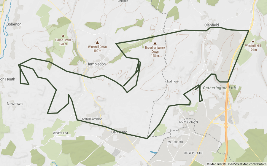
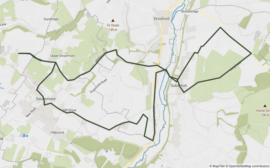
Ready-made GPX routes
Curated loops that run mostly inside the park, built from lanes that were open when we made them.
Questions riders ask
Can you ride green lanes in the South Downs?
Yes, on lanes with the right legal status. We've mapped 235 BOATs and UCRs inside the South Downs that are open to motorcycles, about 117 km in total. Another 342 restricted byways inside the park are for walkers, cyclists and horse riders only.
Are any green lanes in the South Downs closed?
Some are. We've researched 4 named lanes inside the South Downs with a permanent, seasonal or temporary restriction, listed on this page. The list is a snapshot, not a live feed, so always check a lane's current status before you ride.
What is the longest green lane in the South Downs?
Of the named lanes open to motorcycles, Old Coach Road is the longest we've mapped inside the park, at about 4.1 km.
Are there GPX routes for the South Downs?
Yes. 2 ready-made Holloway GPX routes run mostly inside the park, linked on this page. Downloading them, or building your own, is part of Holloway Premium.
Ride the South Downs with Holloway
The map, every lane’s legal status and hazards are free with a quick email sign-in.
Open the map, free Or unlock route planning and GPX with PremiumLane data from OpenStreetMap contributors and council rights of way records. Park boundary © Natural England / Natural Resources Wales, via OpenStreetMap, OGL. Reference only: legal status changes, check signage and current Traffic Regulation Orders before riding.