
Built automatically from council rights of way records, traffic orders and OpenStreetMap data, and checked by Holloway. How we check it
Every mapped lane in the park
Inside the real park boundary. Numbers match the longest lanes list below. Tap the key to show or hide a layer.
See every lane’s name, surface and status.
Open the live map →What you can ride
297 mapped lanes and byways inside the boundary, by legal type.
Difficulty
Most lanes here aren't graded yet, so treat difficulty as unknown and check each lane's detail card before you go.
Longest open lanes
Named lanes open to motorcycles, each measured end to end across all its mapped sections.
-
1
Old Coach Road8.0 km
-
2
Breast High Road3.2 km
-
3
Dubbs Road2.7 km
-
4
Tilberthwaite Road2.5 km
-
5
Bletherbarrow Lane2.2 km
-
6
Gamblesmire Lane2.0 km
-
7
Sow How Lane1.0 km
-
8
Scar House Lane1.0 km
Holloway Premium
Link the Lake District’s lanes into one route
- Navigate to any lane start in one tap
- Plan routes across several lanes, with real road links between them
- Export GPX for your GPS unit or phone app
- Live navigation on a bar-mounted phone
- Save and share your routes
£1 from every membership goes toward keeping lanes open.
Good to know before you ride here
- Most lane restrictions here are made by the Lake District National Park Authority.
- Garburn Pass and Walna Scar Road were settled as restricted byways after long disputes, so they are not open to motor vehicles.
- Tilberthwaite Road and High Oxen Fell Road stayed open: the park authority chose not to restrict them in 2019, and a 2020 judicial review of that decision failed.
Closures and restrictions
Named lanes inside the park with a restriction we’ve found. Tap one for the details.
-
Gatescarth PassPermit only
Lake District National Park Authority permit scheme: Gatescarth Pass is closed to ordinary motor traffic and only open to motorcycles on specific permit days (the first Friday, Saturday or Sunday of each month, gate combination available 9am-4pm), with a quota of 18 motorcycles/day and a minimum group size of 2, no solo riders. Not legal to ride without a valid permit on a permit day. Separately, 4x4 vehicles are currently prohibited entirely due to a structural safety issue with the Gatescarth Beck bridge, motorcycles are not affected by that specific restriction.
Plus 2 unnamed sections with a restriction, shown in red on the map above.
A snapshot, not a live feed. Researched from council and park authority orders, last built 13 November 2026. Restrictions change, so check each lane’s current status in the app, or with its Legal Status Search, before you ride.
Ready-made GPX routes
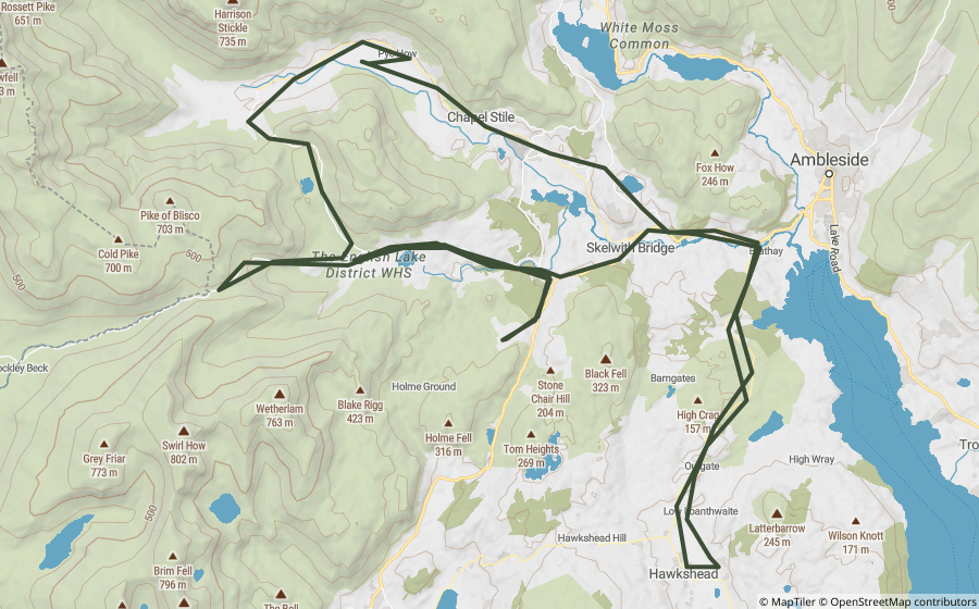
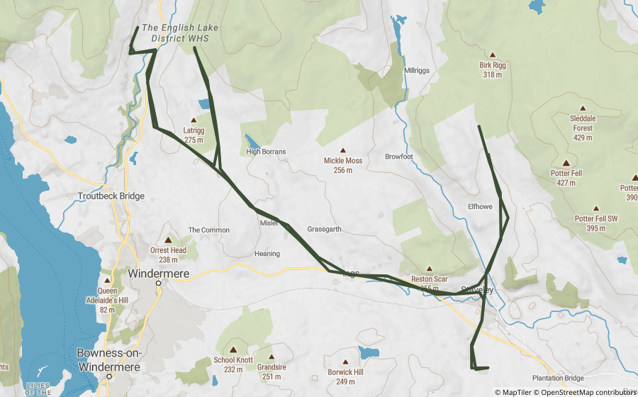
Curated loops that run mostly inside the park, built from lanes that were open when we made them.
Scenic roads and passes
Ordinary paved roads worth riding for their own sake, no rights of way question at all.
Questions riders ask
Can you ride green lanes in the Lake District?
Yes, on lanes with the right legal status. We've mapped 201 BOATs and UCRs inside the Lake District that are open to motorcycles, about 101 km in total. Another 85 restricted byways inside the park are for walkers, cyclists and horse riders only.
Are any green lanes in the Lake District closed?
Some are. We've researched 1 named lane inside the Lake District with a permanent, seasonal or temporary restriction, listed on this page. The list is a snapshot, not a live feed, so always check a lane's current status before you ride.
What is the longest green lane in the Lake District?
Of the named lanes open to motorcycles, Old Coach Road is the longest we've mapped inside the park, at about 8.0 km.
Are there GPX routes for the Lake District?
Yes. 2 ready-made Holloway GPX routes run mostly inside the park, linked on this page. Downloading them, or building your own, is part of Holloway Premium.
Ride the Lake District with Holloway
The map, every lane’s legal status and hazards are free with a quick email sign-in.
Open the map, free Or unlock route planning and GPX with PremiumLane data from OpenStreetMap contributors and council rights of way records. Contains public sector information licensed under the Open Government Licence v3.0. Contains OS data © Crown copyright and database rights 2026. Park boundary © Natural England / Natural Resources Wales, via OpenStreetMap, OGL. Reference only: legal status changes, check signage and current Traffic Regulation Orders before riding. How we check this data.