
Every mapped lane in the park
Inside the real park boundary. Numbers match the longest lanes list below. Tap the key to show or hide a layer.
See every lane’s name, surface and status.
Open the live map →What you can ride
399 mapped lanes and byways inside the boundary, by legal type.
Difficulty
All estimated from OpenStreetMap trail-condition tags, not a rider’s assessment.
Longest open lanes
Named lanes open to motorcycles, each measured end to end across all its mapped sections.
-
1
Houndkirk Road3.8 km
-
2
Beeley Bar Lane2.8 km
-
3
Brough Lane2.6 km
-
4
Stake Hill Road2.6 km
-
5
Cumberland Clough2.1 km
-
6
Buxton Old Coach Road2.0 km
-
7
Tideswell Lane1.9 km
-
8
Slancote Lane1.7 km
Holloway Premium
Link the Peak District’s lanes into one route
- Navigate to any lane start in one tap
- Plan routes across several lanes, with real road links between them
- Export GPX for your GPS unit or phone app
- Live navigation on a bar-mounted phone
- Save and share your routes
£1 from every membership goes toward keeping lanes open.
Good to know before you ride here
- Two authorities can restrict a lane here: the county council, and the Peak District National Park Authority, which makes its own Traffic Regulation Orders.
- Several of the best-known Peak lanes, including Long Causeway, Chapel Gate, Derby Lane and Leys Lane, carry permanent orders. They are listed below.
Closures and restrictions
Named lanes inside the park with a restriction we’ve found. Tap one for the details.
-
Derby LaneClosed to motor vehicles
TRO: Peak District National Park Authority (Derby Lane Prohibition of Mechanically Propelled Vehicles) Traffic Regulation Order 2017 (Derby Lane, Monyash, BOAT 29, Summerhill Farm to Long Rake Road). Permanent Prohibition of Mechanically Propelled Vehicles, no general public motor vehicle access at any time. Emergency services, statutory undertakers and permit holders exempt.
-
Long CausewayClosed to motor vehicles
TRO: Peak District National Park Authority (Long Causeway Prohibition of Mechanically Propelled Vehicles) Traffic Regulation Order 2014 (Long Causeway, Redmires Reservoir/Sheffield BOAT 9 to Dennis Knoll/Outseats BOAT 48, covers both the Derbyshire and South Yorkshire sides of one continuous road). Permanent Prohibition of Mechanically Propelled Vehicles, no general public motor vehicle access at any time. Emergency services, statutory undertakers and permit holders exempt.
-
Chapel GateClosed to motor vehicles
TRO: Peak District National Park Authority (Chapel Gate Prohibition of Mechanically Propelled Vehicles) Traffic Regulation Order 2014 (Chapel Gate, BOAT 16 Edale and BOAT 144 Chapel-en-le-Frith, Sheffield Road to Edale Road near Barber Booth). Permanent Prohibition of Mechanically Propelled Vehicles, no general public motor vehicle access at any time. Emergency services, statutory undertakers and permit holders exempt.
-
Leys LaneClosed to motor vehicles
TRO: Peak District National Park Authority (Leys Lane Prohibition of Mechanically Propelled Vehicles) Traffic Regulation Order 2015 (Leys Lane, Little Longstone, BOAT 14, the section from Dale Farm before it continues as Chertpit Lane). Permanent Prohibition of Mechanically Propelled Vehicles, no general public motor vehicle access at any time. Emergency services, statutory undertakers and permit holders exempt.
-
Jacob’s LadderClosed to motor vehicles
Closed to all mechanically propelled vehicles by The Derbyshire County Council (Stoney Middleton Byway Open to all Traffic No.15 (Jacob's Ladder)) Prohibition of Mechanically Propelled Vehicles Order 2019, in force since 2 August 2019, except emergency and statutory services, land/premises access, and with the Authority's written permission. Confirmed directly against the order text, Derbyshire CC permanent TRO register.
-
WashgateClosed to motor vehicles
TRO: Peak District National Park Authority (Washgate Prohibition of Mechanically Propelled Vehicles) Traffic Regulation Order 2017 (Washgate, Booth Farm to the River Dove and on into Staffordshire). Permanent Prohibition of Mechanically Propelled Vehicles, no general public motor vehicle access at any time. Emergency services, statutory undertakers and permit holders exempt. A narrow motorcycle exemption exists only for machines taking part in the organised Bemrose Trial or Reliance Cup Trial, on terms set by the Authority, not a standing right for ordinary riders.
-
Cumberland CloughCars restricted, motorcycles still legal
Not accessible to cars or general traffic (width, TRO, or condition), legal for motorcycles
Plus 3 unnamed sections with a restriction, shown in red on the map above.
A snapshot, not a live feed. Researched from council and park authority orders, last built 23 September 2026. Restrictions change, so check each lane’s current status in the app, or with its Legal Status Search, before you ride.
Ready-made GPX routes
Curated loops that run mostly inside the park, built from lanes that were open when we made them.
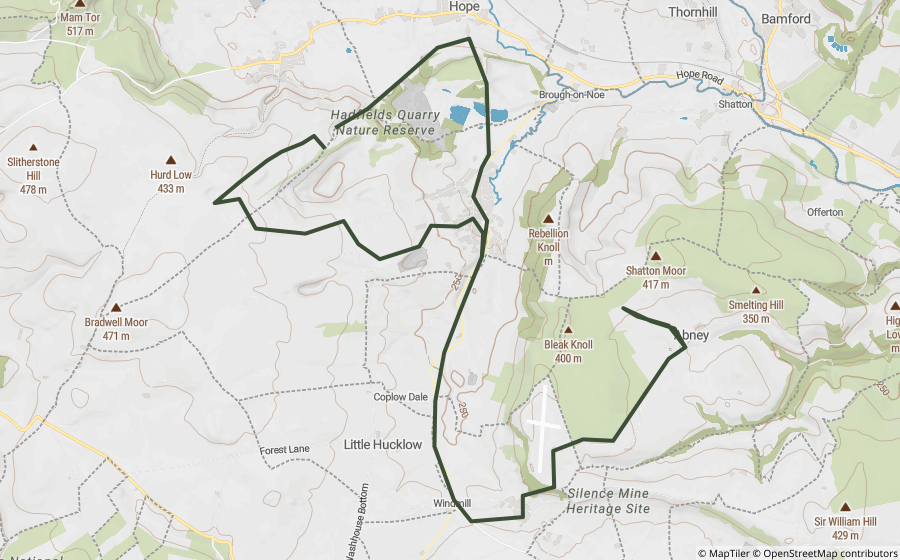
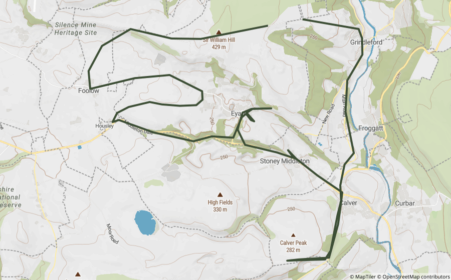
Scenic roads and passes
Ordinary paved roads worth riding for their own sake, no rights of way question at all.
Places worth a stop
30 historic sites and landmarks inside the park, all on the map. Access rights not checked, look before you visit.

One of Castleton's four show caves, and one of only two places left in the world where the ornamental mineral Blue John is still mined.

A flooded former lead mine at Castleton, explored today by boat along a canal cut by hand by 18th-century miners.

A show cave near Castleton and one of only two places where the ornamental mineral Blue John is still dug, in small amounts, for jewellery and ornaments.

Home to Britain's largest natural cave entrance, at Castleton, long nicknamed the Devil's Arse before adopting the tidier name Peak Cavern.

A Bronze Age barrow on Beeley Moor, unusual for being rectangular rather than the round shape typical of the period.

A small Bronze Age stone circle near Birchover, one of several raised on Stanton Moor and the surrounding gritstone edges.

A Neolithic henge on the White Peak plateau, its stone circle lying flat within a bank and ditch rather than standing upright.

A Neolithic chambered tomb on Taddington Moor, one of the highest such tombs in England.

Eyam's own plague museum, telling the story of the village that chose to isolate itself during a 1665-66 outbreak to stop the disease spreading further.

A tree-topped hill in the White Peak, its clump of beeches hiding a Neolithic chambered tomb and two Bronze Age barrows.
Questions riders ask
Can you ride green lanes in the Peak District?
Yes, on lanes with the right legal status. We've mapped 237 BOATs and UCRs inside the Peak District that are open to motorcycles, about 102 km in total. Another 119 restricted byways inside the park are for walkers, cyclists and horse riders only.
Are any green lanes in the Peak District closed?
Some are. We've researched 6 named lanes inside the Peak District with a permanent, seasonal or temporary restriction, listed on this page. The list is a snapshot, not a live feed, so always check a lane's current status before you ride.
What is the longest green lane in the Peak District?
Of the named lanes open to motorcycles, Houndkirk Road is the longest we've mapped inside the park, at about 3.8 km.
Are there GPX routes for the Peak District?
Yes. 2 ready-made Holloway GPX routes run mostly inside the park, linked on this page. Downloading them, or building your own, is part of Holloway Premium.
Ride the Peak District with Holloway
The map, every lane’s legal status and hazards are free with a quick email sign-in.
Open the map, free Or unlock route planning and GPX with PremiumLane data from OpenStreetMap contributors and council rights of way records. Park boundary © Natural England / Natural Resources Wales, via OpenStreetMap, OGL. Reference only: legal status changes, check signage and current Traffic Regulation Orders before riding.