
Every mapped lane in the park
Inside the real park boundary. Numbers match the longest lanes list below. Tap the key to show or hide a layer.
See every lane’s name, surface and status.
Open the live map →What you can ride
253 mapped lanes and byways inside the boundary, by legal type.
Difficulty
All estimated from OpenStreetMap trail-condition tags, not a rider’s assessment.
Longest open lanes
Named lanes open to motorcycles, each measured end to end across all its mapped sections.
-
1
Cam High Road10 km
-
2
Gilbert Lane4.2 km
-
3
Busk Lane3.7 km
-
4
Long Lane3.4 km
-
5
High Lane3.3 km
-
6
West Cam Road3.0 km
-
7
Mitchell Lane2.0 km
-
8
Tow Scar Lane1.7 km
Holloway Premium
Link the Yorkshire Dales’s lanes into one route
- Navigate to any lane start in one tap
- Plan routes across several lanes, with real road links between them
- Export GPX for your GPS unit or phone app
- Live navigation on a bar-mounted phone
- Save and share your routes
£1 from every membership goes toward keeping lanes open.
Good to know before you ride here
- The Yorkshire Dales National Park Authority publishes its own list of current Traffic Regulation Orders, separate from the county councils.
- Mastiles Lane, one of the most famous lanes in the Dales, is closed to ordinary motor traffic.
Closures and restrictions
Named lanes inside the park with a restriction we’ve found. Tap one for the details.
-
Gorbeck RoadClosed to motor vehicles
TRO: Yorkshire Dales National Park Authority (Gorbeck Road) Traffic Regulation Order 2010, in force since August 2010 (Langcliffe to Malham). Permanent Prohibition of Mechanically Propelled Vehicles, no general public motor vehicle access at any time. Emergency services, statutory undertakers and land access exempt.
-
Turbary RoadClosed to motor vehicles
Closed to all motor vehicles except access (fire/police/ambulance, statutory works, premises access), by North Yorkshire County Council (Prohibition of Motor Vehicles except for Access) (Unclassified Road IN36G (Turbary Road), Thornton in Lonsdale) Order 2016, in force since 14 November 2016. Confirmed directly against the order text, North Yorkshire CC rights of way notices register.
-
Mastiles LaneClosed to motor vehicles
TRO: Yorkshire Dales National Park Authority (Mastiles Lane) Traffic Regulation Order 2008, in force since August 2008 (Street Gate near Malham Tarn to Kilnsey). Permanent Prohibition of Mechanically Propelled Vehicles, no general public motor vehicle access at any time. Emergency services, statutory undertakers and land access exempt. A narrow motorcycle exemption exists only for machines taking part in the organised Alan Jeffries Trial, not a standing right for ordinary riders.
-
Cam High RoadClosed to motor vehicles
Closed to all mechanically propelled vehicles by the Yorkshire Dales National Park Authority (Cam High Road) (Prohibition of Mechanically Propelled Vehicles) Traffic Regulation Order 2008, in force since 6 August 2008. Covers the 4.8km stretch from the B6255 near Far Gearstones to the Cam Houses access track, exempting emergency/statutory services, land access and agriculture. Confirmed directly against the order text and by measuring along the lane chain from the Gearstones end, this segment falls within the closed stretch. Most of the rest of that 4.8km is already a restricted byway, not affected by this BOAT-specific closure.
-
Nipe LaneCars restricted, motorcycles still legal
Not accessible to cars or general traffic (width, TRO, or condition), legal for motorcycles
A snapshot, not a live feed. Researched from council and park authority orders, last built 23 September 2026. Restrictions change, so check each lane’s current status in the app, or with its Legal Status Search, before you ride.
Ready-made GPX routes
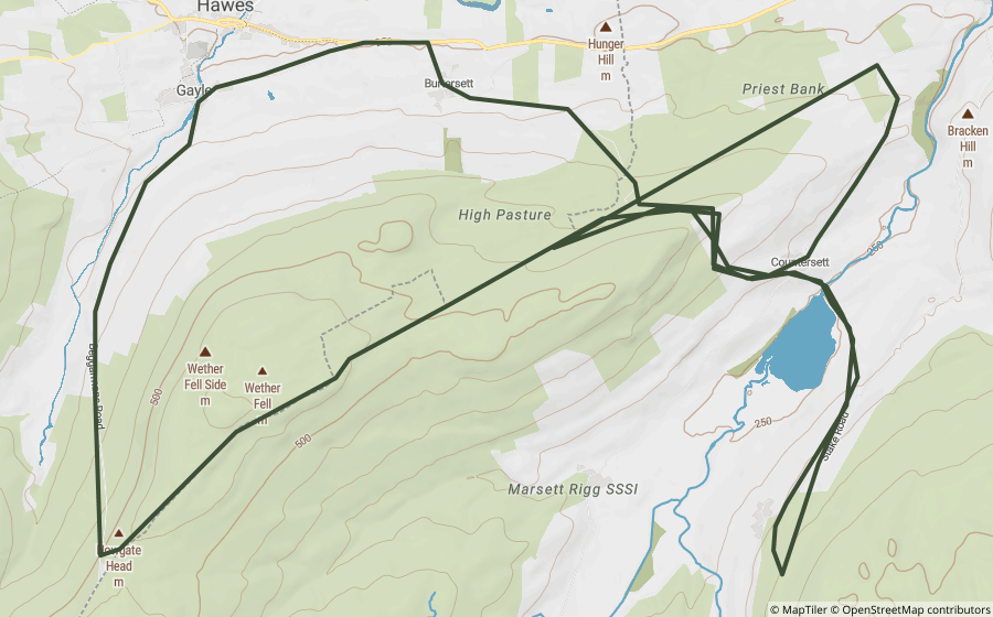
Curated loops that run mostly inside the park, built from lanes that were open when we made them.
Scenic roads and passes
Ordinary paved roads worth riding for their own sake, no rights of way question at all.
Places worth a stop
1 historic site and landmark inside the park, all on the map. Access rights not checked, look before you visit.

A probable Iron Age settlement near Grinton in Swaledale, a scheduled monument sharing its name with several unrelated 'Maiden Castle' sites across Britain, most likely all just meaning a fortification that looks impregnable.
Questions riders ask
Can you ride green lanes in the Yorkshire Dales?
Yes, on lanes with the right legal status. We've mapped 198 BOATs and UCRs inside the Yorkshire Dales that are open to motorcycles, about 129 km in total. Another 47 restricted byways inside the park are for walkers, cyclists and horse riders only.
Are any green lanes in the Yorkshire Dales closed?
Some are. We've researched 4 named lanes inside the Yorkshire Dales with a permanent, seasonal or temporary restriction, listed on this page. The list is a snapshot, not a live feed, so always check a lane's current status before you ride.
What is the longest green lane in the Yorkshire Dales?
Of the named lanes open to motorcycles, Cam High Road is the longest we've mapped inside the park, at about 10 km.
Are there GPX routes for the Yorkshire Dales?
Yes. One ready-made Holloway GPX route runs mostly inside the park, linked on this page. Downloading them, or building your own, is part of Holloway Premium.
Ride the Yorkshire Dales with Holloway
The map, every lane’s legal status and hazards are free with a quick email sign-in.
Open the map, free Or unlock route planning and GPX with PremiumLane data from OpenStreetMap contributors and council rights of way records. Park boundary © Natural England / Natural Resources Wales, via OpenStreetMap, OGL. Reference only: legal status changes, check signage and current Traffic Regulation Orders before riding.