
Can you ride the Wessex Ridgeway on a motorbike?
Partly.
- 28 km of the Wessex Ridgeway is a byway or unclassified road open to motorcycles all year.
- Another 2.0 km is closed to motor vehicles from 1 Oct to 30 Apr by a seasonal order, and open the rest of the year.
- 154 km is a restricted byway, bridleway or footpath, with no right to ride a motorbike.
- 29 km follows public roads, which you can ride but aren’t green lanes.
The Wessex Ridgeway, end to end
The whole route straightened out, from Marlborough (top left) to Lyme Regis, coloured by what you can legally ride.
- Open to motorcycles 28 km
- Seasonal closure 2.0 km
- Restricted byway, no motors 8.7 km
- Footpath, bridleway or path 145 km
- Public road 29 km
- Track, no recorded right of way 6.5 km
On the map
A is the start, B the end. The same colours as the strip above.
See every lane’s name, surface and current status.
Open the live map →Section by section
Every stretch of byway along the route, in order. Distances are from Marlborough.
-
12.4to 13.1 km
Hawkmoor Hill0.7 km
Near Hawkchurch
-
21.0to 21.3 km
Attisham Lane0.4 km
Near Winsham
-
27.7to 28.3 km
Unnamed byway0.7 km
Near Broadwindsor
-
34.0to 34.7 km
Stintford Lane0.7 km
Near Chedington
-
35.9to 37.8 km
Unnamed byway1.9 km
Near Chedington
-
41.6to 42.1 km
Unnamed byway0.4 km
Near North Poorton
-
45.3to 45.5 km
Unnamed byway0.2 km
Near Toller Porcorum
-
60.1to 60.7 km
Unnamed byway0.5 km
Near Batcombe
-
62.3to 62.8 km
Bazan Barn Road0.5 km
Near Cerne Abbas
-
67.5to 68.3 km
Holcombe Dairy Lane0.8 km
Near Buckland Newton
-
70.8to 71.8 km
Restricted byway1.0 km
Near Plush
-
83.0to 84.0 km
Restricted byway1.0 km
From near Belchalwell to near Okeford Fitzpaine
-
87.2to 87.4 km
Holloway Lane0.3 km
From near Shillingstone to near Durweston
-
103.2to 105.2 km
Benches Lane2.1 km
From near Ashmore to near Tollard Royal
-
112.3to 113.0 km
Back Horse Hill Lane0.7 km
From near Ludwell to near Donhead St Mary
-
114.0to 115.2 km
Shepherd's Lane and Dengrove Hill1.3 km
From near Donhead St Mary to near Donhead St Andrew
-
126.1to 128.3 km
The Down2.2 km
From near East Knoyle to near Hindon
-
130.2to 130.8 km
Ox Drove0.6 km
Near Chicklade
-
136.6to 137.8 km
Restricted byway1.2 km
From near Boyton to near Corton
-
151.4to 151.9 km
Restricted byway0.5 km
Near Warminster
-
159.1to 159.5 km
Port Way0.4 km
Near Bratton
-
165.3to 169.2 km
From near Edington to near Imber
-
172.3to 172.7 km
Unnamed byway0.3 km
Near Great Cheverell
-
175.5to 176.7 km
Unnamed byway1.3 km
Near Market Lavington
-
177.1to 180.4 km
Unnamed byway3.2 km
From near Market Lavington to near Wedhampton
-
186.3to 188.4 km
Unnamed byway2.1 km
From near Etchilhampton to near Devizes
-
189.0to 189.3 km
Gipsy Lane0.3 km
Near Devizes
-
193.5to 194.4 km
Unnamed byway0.9 km
Near Rowde
-
195.8to 196.2 km
Unnamed byway0.4 km
Near Heddington
-
196.7to 198.9 km
Unnamed byway2.2 km
From near Stockley to near Bishops Cannings
-
199.6to 202.0 km
Unnamed byway2.3 km
From near Bishops Cannings to near Cherhill
-
203.2to 204.0 km
Unnamed byway0.9 km
From near Cherhill to near Compton Bassett
-
207.1to 207.5 km
Unnamed byway0.5 km
Near Beckhampton
-
209.6to 210.2 km
Herepath0.6 km
From near Winterbourne Monkton to near East Kennett
-
210.2to 211.8 km
Herepath1.5 km
From near East Kennett to near West Overton
What riding it is like
Holloway Premium
Ride the Wessex Ridgeway as one route
- Link its open lanes with real road connections between them
- Export GPX for your GPS unit or phone app
- Live navigation on a bar-mounted phone
- Seasonal closures shown on the dates they apply
£1 from every membership goes toward keeping lanes open.
Closures and orders on the route
Every restriction we’ve found on lanes along the Wessex Ridgeway. Tap one for the details.
-
HerepathSeasonal, 1 Oct to 30 Apr
Seasonal vehicle restriction, closed Oct to Apr (from OSM tagging, verify locally).
-
Unnamed sectionSeasonal, 1 Oct to 30 Apr
Seasonal vehicle restriction, closed Oct to Apr (from OSM tagging, verify locally).
A snapshot, not a live feed. Researched from council and park authority orders, last built 9 October 2026. Check each lane’s current status in the app before you ride.
About the Wessex Ridgeway
- A long-distance trail along the chalk ridges of Wessex, from Marlborough to the coast at Lyme Regis.
- It crosses Salisbury Plain, Cranborne Chase and the Dorset downs, following old ridgeways and drove roads.
Ride it well
- Walkers, horse riders and cyclists use it too. Slow right down and stop the engine for horses.
- Ride in small groups, stay on the line of the lane, and don’t ride a soft surface that you’d rut.
- Seasonal orders exist to stop winter damage, and lanes stay open when riders respect them.
Ready-made GPX routes nearby
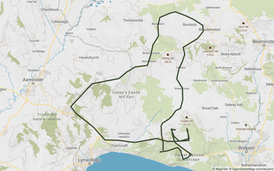
Holloway loops that use lanes on or close to the Wessex Ridgeway.
Places along the way
Historic sites and landmarks within a mile or so of the route. Access not checked, look before you visit.

A small museum at Devizes Wharf on the history and restoration of the Kennet and Avon Canal.

A 38-metre obelisk near Cherhill, put up in 1845 to honour an ancestor of the man who built it.

A museum built from a marmalade fortune, after its founder spent the 1920s and 30s buying up and excavating most of Avebury himself.

A Tudor manor house built on the site of a Benedictine priory, restored room by room for the BBC series The Manor Reborn.

An Iron Age hillfort above Westbury, with the White Horse cut into the hillside below it sometime before the horse was first recorded in 1742.

A chalk hill figure cut in 1804, designed by a schoolboy at a local academy that closed not long after.
Britain's largest stone circle, bigger than Stonehenge but quieter, with a whole village built inside its ancient bank and ditch.

The tallest prehistoric mound in Europe, built by hand around 2400 BC for reasons nobody has ever established for certain.

Hod Hill, a large Iron Age hillfort in the Blackmore Vale, with the neighbouring hillfort of Hambledon Hill visible just to the north.

A bronze statue in Lyme Regis of the pioneering fossil hunter who grew up finding ammonites and ichthyosaurs along this coast.
Questions riders ask
Can you ride the Wessex Ridgeway on a motorbike?
Partly. 28 km of the Wessex Ridgeway is a byway or unclassified road open to motorcycles all year. Another 2.0 km is closed to motor vehicles from 1 Oct to 30 Apr by a seasonal order, and open the rest of the year. 154 km is a restricted byway, bridleway or footpath, with no right to ride a motorbike. Legal status changes, so check each lane’s current status before you ride.
Is the Wessex Ridgeway open to motorbikes in winter?
Not all of it. 2.0 km is under seasonal orders that close it to motor vehicles from 1 Oct to 30 Apr. The rest of the open lanes stay open all year, subject to any temporary closure.
How long is the Wessex Ridgeway?
The Wessex Ridgeway runs about 219 km from Marlborough to Lyme Regis, measured along its mapped line.
Is there a GPX route for the Wessex Ridgeway?
One ready-made Holloway GPX route uses lanes on or near it, linked on this page. Downloading them, or building your own along the Wessex Ridgeway, is part of Holloway Premium.
Ride the Wessex Ridgeway with Holloway
Every lane along it, with its legal status and hazards, is on the Holloway map, free with a quick email sign-in.
Open the map, free Or plan a route along it with PremiumRoute lines and lane data from OpenStreetMap contributors (ODbL) and council rights of way records via rowmaps.com. Contains public sector information licensed under the Open Government Licence v3.0. Contains OS data © Crown copyright and database rights 2026. Reference only: legal status changes, check signage and current Traffic Regulation Orders before riding. How we check this data.