
Can you ride the Fosse Way on a motorbike?
Partly.
- 19 km of the Fosse Way is a byway or unclassified road open to motorcycles all year.
- 16 km is a restricted byway, bridleway or footpath, with no right to ride a motorbike.
- 252 km follows public roads, which you can ride but aren’t green lanes.
The Fosse Way, end to end
The whole route straightened out, from Seaton, Devon (top left) to Lincoln, coloured by what you can legally ride.
- Open to motorcycles 19 km
- Restricted byway, no motors 4.9 km
- Footpath, bridleway or path 11 km
- Public road 252 km
- Track, no recorded right of way 2.6 km
- No path today, or line not mapped 53 km
Pale grey is where the old line crosses fields or isn’t mapped any more, about 53 km in all.
On the map
A is the start, B the end. The same colours as the strip above.
See every lane’s name, surface and current status.
Open the live map →Section by section
Every stretch of byway along the route, in order. Distances are from Seaton, Devon.
-
31.3to 32.1 km
Long Lane0.8 km
From near Lopen to near Over Stratton
-
67.7to 68.8 km
Fosse Way1.2 km
Near Doulting
-
69.1to 69.7 km
Yellingmill Lane0.6 km
From near Doulting to near Oakhill
-
70.0to 71.1 km
Fosse Way1.1 km
Near Oakhill
-
79.8to 80.7 km
Fosse Way0.9 km
Near Radstock
-
84.8to 85.7 km
Unnamed byway0.9 km
Near Dunkerton
-
86.0to 87.7 km
Fosse Way1.7 km
From near Priston to near Combe Hay
-
97.2to 97.7 km
Fosse Lane0.4 km
Near Bathford
-
110.6to 112.7 km
Fosse Way2.1 km
From near Littleton Drew to near Grittleton
-
116.2to 117.7 km
Fosse Way1.5 km
From near Sherston to near Norton
-
118.0to 120.6 km
Fosse Way2.6 km
From near Foxley to near Easton Grey
-
120.6to 124.2 km
Fosse Way3.5 km
From near Shipton Moyne to near Long Newnton
-
124.2to 130.5 km
Fosse Way6.4 km
From near Long Newnton to near Rodmarton
What riding it is like
Holloway Premium
Ride the Fosse Way as one route
- Link its open lanes with real road connections between them
- Export GPX for your GPS unit or phone app
- Live navigation on a bar-mounted phone
- Seasonal closures shown on the dates they apply
£1 from every membership goes toward keeping lanes open.
About the Fosse Way
- A Roman road built in the first century AD, running from the Devon coast to Lincoln, the Roman Lindum.
- Much of its line now lies under modern roads such as the A37, A429 and A46. The green lanes are the stretches that survive as byways.
Ride it well
- Walkers, horse riders and cyclists use it too. Slow right down and stop the engine for horses.
- Ride in small groups, stay on the line of the lane, and don’t ride a soft surface that you’d rut.
- Seasonal orders exist to stop winter damage, and lanes stay open when riders respect them.
Ready-made GPX routes nearby
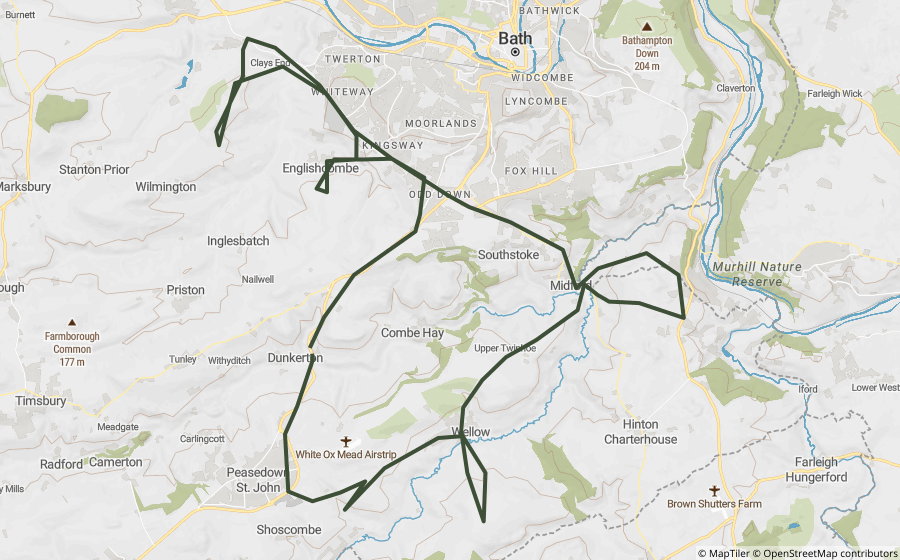
Holloway loops that use lanes on or close to the Fosse Way.
Places along the way
Historic sites and landmarks within a mile or so of the route. Access not checked, look before you visit.

A Queen Anne-style Grade II* listed house on the edge of Leicester, built 1709-13.

The ruins of a wealthy 12th-century Augustinian abbey where Cardinal Wolsey died in 1530.

The site of a Franciscan friary in Leicester, dissolved in 1538 and later the discovery site of Richard III's remains.

A Grade II listed 1889 shopping arcade in central Leicester.

A Grade I listed 1400s gateway, once the entrance to a walled religious precinct, now a solitary Leicester landmark.

One of Britain's first public museums, opened in 1849 on Leicester's New Walk.

A Leicester museum covering post-medieval city history and the Royal Leicestershire Regiment.

A substantial ruined wall of 2nd-century Roman masonry in the centre of Leicester.

Leicester's Haymarket Memorial Clock Tower, a well-known city-centre meeting point.

A museum of science and technology in a former Victorian sewage pumping station.
Questions riders ask
Can you ride the Fosse Way on a motorbike?
Partly. 19 km of the Fosse Way is a byway or unclassified road open to motorcycles all year. 16 km is a restricted byway, bridleway or footpath, with no right to ride a motorbike. 252 km follows public roads, which you can ride but aren’t green lanes. Legal status changes, so check each lane’s current status before you ride.
How long is the Fosse Way?
The Fosse Way runs about 342 km from Seaton, Devon to Lincoln, measured along its mapped line. About 53 km of that has no mapped line today.
Is there a GPX route for the Fosse Way?
One ready-made Holloway GPX route uses lanes on or near it, linked on this page. Downloading them, or building your own along the Fosse Way, is part of Holloway Premium.
Ride the Fosse Way with Holloway
Every lane along it, with its legal status and hazards, is on the Holloway map, free with a quick email sign-in.
Open the map, free Or plan a route along it with PremiumRoute lines and lane data from OpenStreetMap contributors (ODbL) and council rights of way records via rowmaps.com. Contains public sector information licensed under the Open Government Licence v3.0. Contains OS data © Crown copyright and database rights 2026. Reference only: legal status changes, check signage and current Traffic Regulation Orders before riding. How we check this data.