
Can you ride the Ox Drove on a motorbike?
Yes, a good part of it.
- 12 km of the Ox Drove is a byway or unclassified road open to motorcycles all year.
- Another 1.9 km is closed to motor vehicles from 1 Nov to 31 Mar by a seasonal order, and open the rest of the year.
The Ox Drove, end to end
The whole route straightened out, from Charlton, near Shaftesbury (top left) to Bishopstone, near Salisbury, coloured by what you can legally ride.
- Open to motorcycles 12 km
- Seasonal closure 1.9 km
- No path today, or line not mapped 3.9 km
This route is built from the stretches our data names as the Ox Drove. Between them, the old way runs on roads, tracks and paths, shown pale grey.
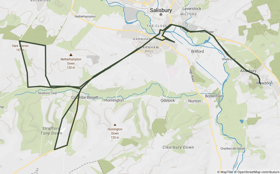
On the map
A is the start, B the end. The same colours as the strip above.
See every lane’s name, surface and current status.
Open the live map →Section by section
Every stretch of byway along the route, in order. Distances are from Charlton, near Shaftesbury.
-
0.0to 0.5 km
Ox Drove0.5 km
From near Charlton to near Ludwell
-
0.5to 2.4 km
Ox Drove1.9 km
Near Ludwell
-
3.8to 7.9 km
Ox Drove4.1 km
From near Berwick St John to near Ebbesbourne Wake
-
9.6to 15.2 km
Ox Drove5.6 km
From near Bowerchalke to near Broad Chalke
-
15.9to 18.0 km
Ox Drove2.0 km
Near Bishopstone
What riding it is like
Holloway Premium
Ride the Ox Drove as one route
- Link its open lanes with real road connections between them
- Export GPX for your GPS unit or phone app
- Live navigation on a bar-mounted phone
- Seasonal closures shown on the dates they apply
£1 from every membership goes toward keeping lanes open.
Closures and orders on the route
Every restriction we’ve found on lanes along the Ox Drove. Tap one for the details.
-
Ox DroveSeasonal, 1 Nov to 31 Mar
Seasonal vehicle restriction, only open Apr to Oct (from OSM tagging, verify locally).
A snapshot, not a live feed. Researched from council and park authority orders, last built 9 October 2026. Check each lane’s current status in the app before you ride.
About the Ox Drove
- An old drove road along the high ridge of Cranborne Chase, on the border of Wiltshire and Dorset.
- Cattle were once driven along routes like this to market, which is why they run along ridgetops rather than through villages.
Ride it well
- Walkers, horse riders and cyclists use it too. Slow right down and stop the engine for horses.
- Ride in small groups, stay on the line of the lane, and don’t ride a soft surface that you’d rut.
- Seasonal orders exist to stop winter damage, and lanes stay open when riders respect them.
Ready-made GPX routes nearby
Holloway loops that use lanes on or close to the Ox Drove.
Questions riders ask
Can you ride the Ox Drove on a motorbike?
Yes, a good part of it. 12 km of the Ox Drove is a byway or unclassified road open to motorcycles all year. Another 1.9 km is closed to motor vehicles from 1 Nov to 31 Mar by a seasonal order, and open the rest of the year. Legal status changes, so check each lane’s current status before you ride.
Is the Ox Drove open to motorbikes in winter?
Not all of it. 1.9 km is under seasonal orders that close it to motor vehicles from 1 Nov to 31 Mar. The rest of the open lanes stay open all year, subject to any temporary closure.
How long is the Ox Drove?
The Ox Drove runs about 18 km between the first and last stretches carrying its name in our data.
Is there a GPX route for the Ox Drove?
One ready-made Holloway GPX route uses lanes on or near it, linked on this page. Downloading them, or building your own along the Ox Drove, is part of Holloway Premium.
Ride the Ox Drove with Holloway
Every lane along it, with its legal status and hazards, is on the Holloway map, free with a quick email sign-in.
Open the map, free Or plan a route along it with PremiumRoute lines and lane data from OpenStreetMap contributors (ODbL) and council rights of way records via rowmaps.com. Contains public sector information licensed under the Open Government Licence v3.0. Contains OS data © Crown copyright and database rights 2026. Reference only: legal status changes, check signage and current Traffic Regulation Orders before riding. How we check this data.