
England & Wales · free with an email sign-in
The byways and county roads you can legally ride on a motorcycle, mapped across England and Wales, with the ones you can't ride shown too. Tap any lane to see its type, difficulty, hazards and any closure we know about, then check its legal status in one tap.
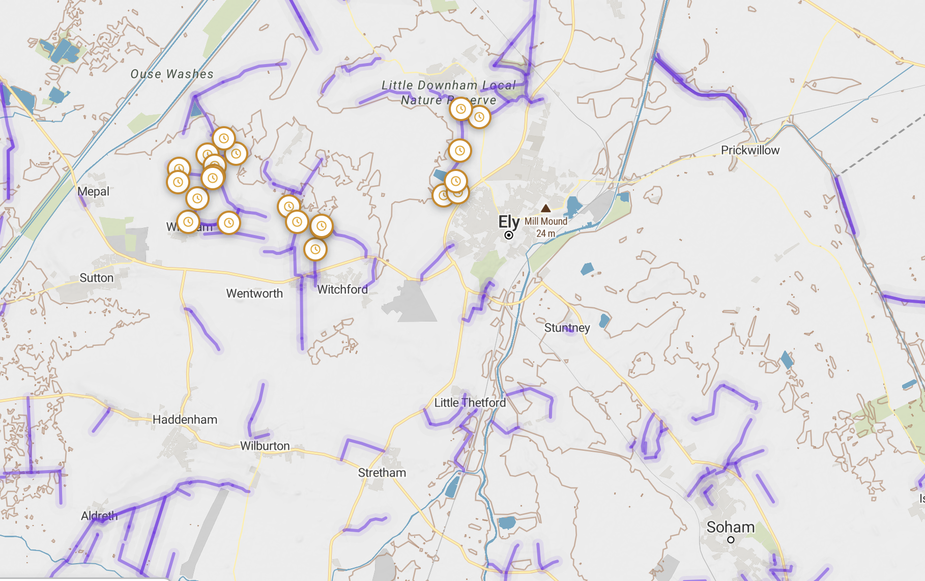
The map itself, near Ely, Cambridgeshire.
*Based on each lane's recorded designation, excluding lanes permanently closed to motor vehicles. Legal status changes, so always check a lane before you ride it. Figures as of 28 September 2026.
Coverage
Each square is about 9 km across, shaded by how much rideable lane Holloway maps inside it.
The most mapped miles are in Wales, Wiltshire, Norfolk, Cambridgeshire, Northumberland and Devon. Lanes survive where old drove roads, ridgeways and farm roads were never tarmacked, so cities and much of the Midlands have far fewer.
Pale areas don't always mean nothing's there. Some councils publish much less than others, and we're adding lanes county by county. If you know a legal lane we've missed, you can trace it on the map and send it in.
Green lanes in the national parksMap key
Colour tells you how hard a lane is. A dashed grey line means you can't ride it on a motorcycle. The lane's legal type, BOAT or UCR, is on its card when you tap it, and you can filter by type.
Rode a lane? Grade it.
Most lanes on the map are still violet, because a grade should come from someone who's actually ridden it, and there are over 10,000 still waiting. Open a lane you know, tap Suggest a difficulty grade, and tell us the surface and hazards. A moderator checks it, then every rider sees it.
Grade a lane you've riddenUsing it
1
Enter your email and tap the link we send you. No password and no card.
2
Tap "Near me", or search by a lane's name or county, and set how hard you want to go.
3
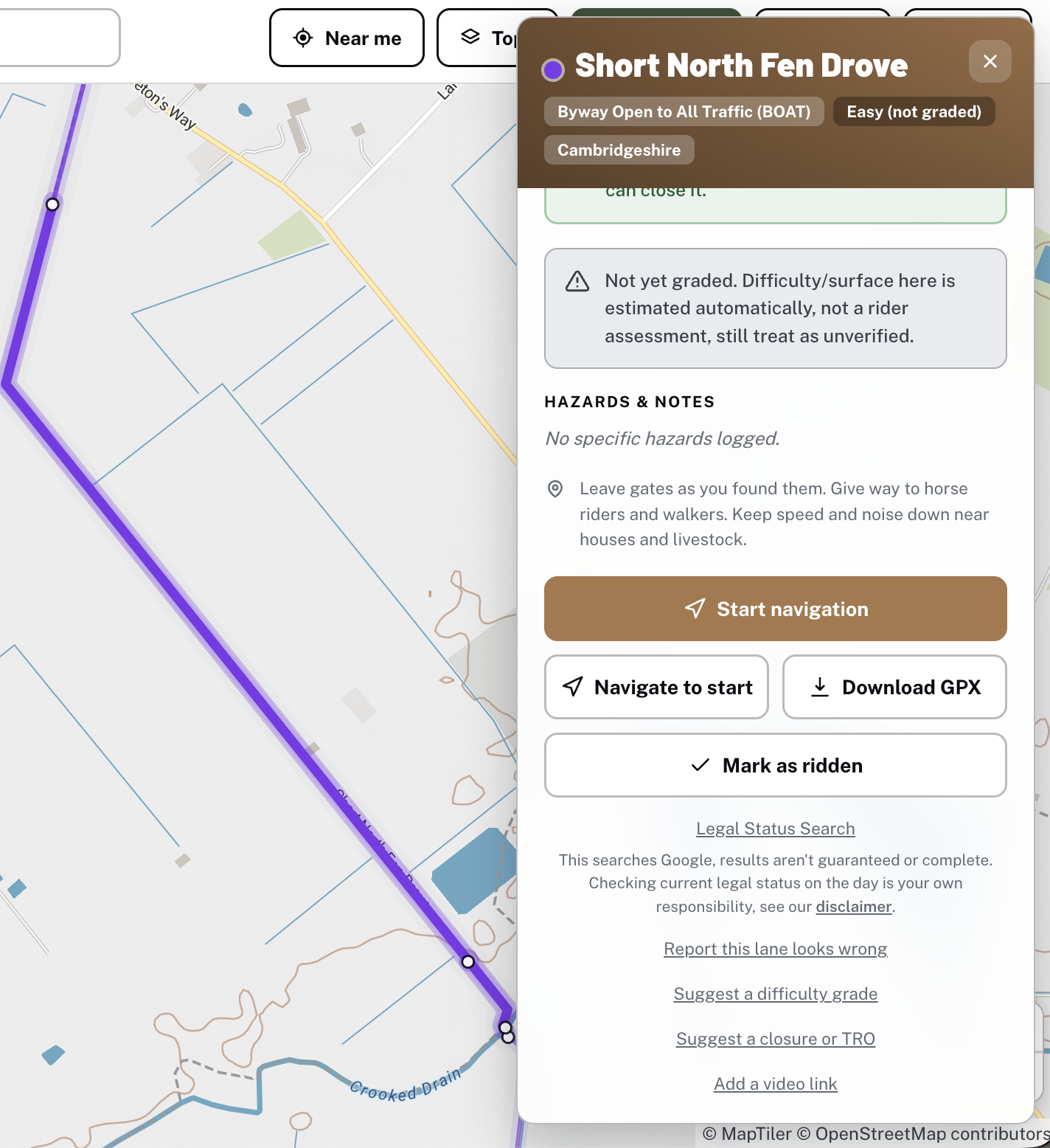
Tap a lane for its type, length, difficulty, hazards and closures, then run its Legal Status Search.
4
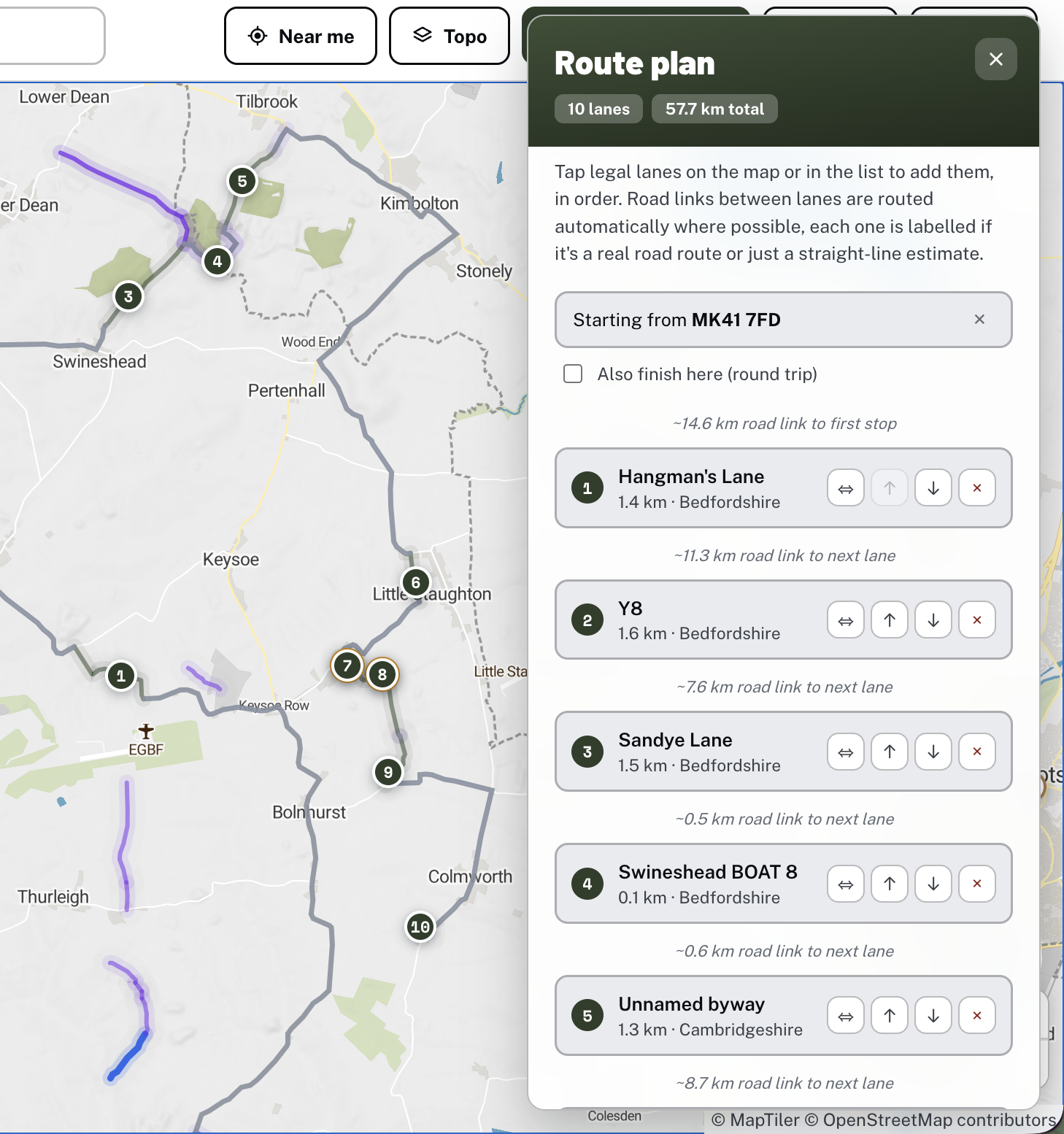
With Premium, navigate to either end in one tap, or plan a whole day and take it with you as a GPX file.
More than a map
Finding a lane is only part of a good day out. These are the parts that turn a lane into a proper ride.
Premium
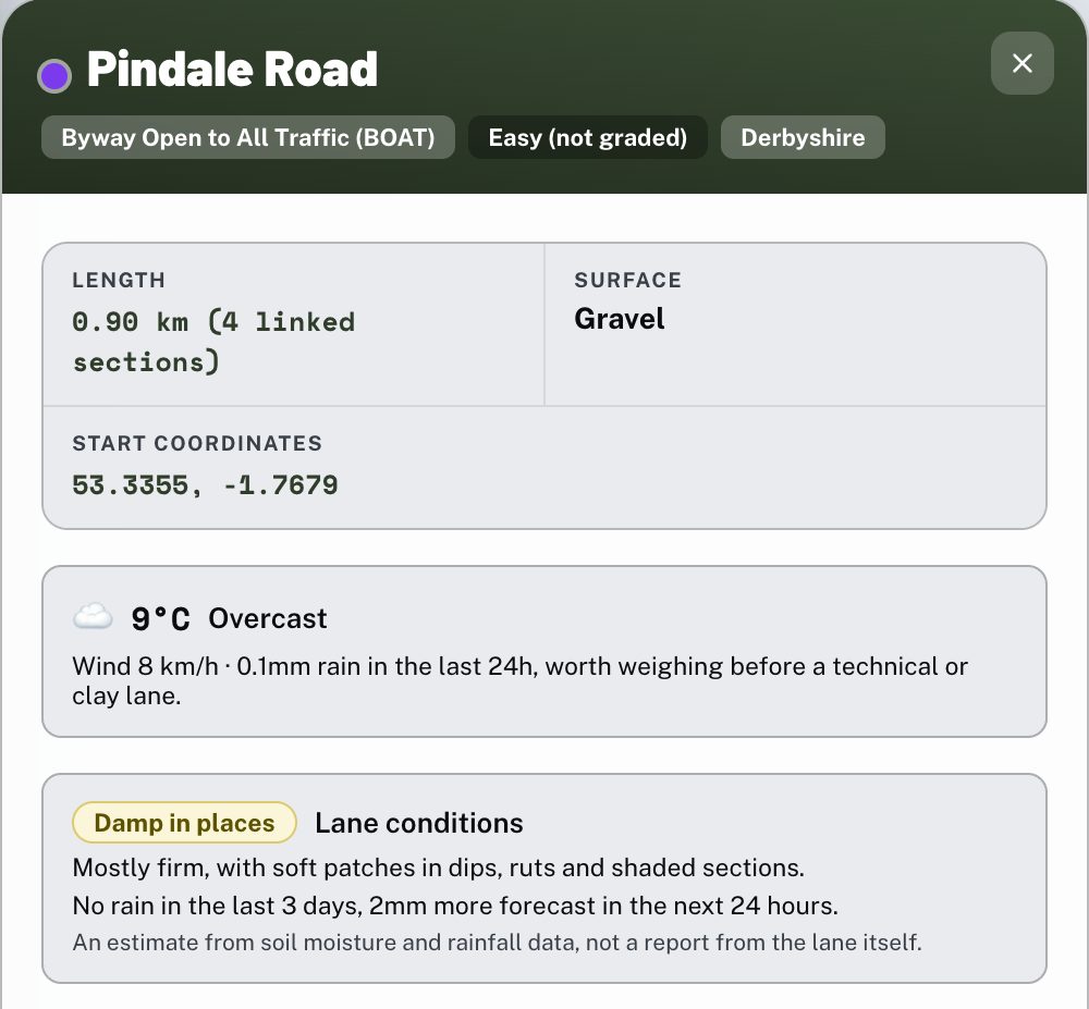
Holloway combines live weather with soil moisture and the last three days of rain at each lane, and estimates whether it'll be dry, damp, wet or deep in mud before you set off. After heavy rain it warns you if a ford on the lane may be running high.
It's an estimate from weather data, not a report from the lane itself, but it's a far better guide than a weather icon when you're deciding between a chalk track and a clay one.
Free
Tap Near me and the map centres on you, with the lanes around you sorted nearest first.
Free
Watch videos other riders have linked to a lane. Filmed one yourself? Add the link from the lane's card.
Free
7,916 fuel stations on the map, so you know where to fill up before a long run of lanes.
Free
1,495 castles, hill forts and landmarks mapped alongside the lanes, with a short write-up for each.
Premium
String lanes into a route, then send the plan to friends or family by WhatsApp, text or email in a couple of taps. It's quicker for planning a ride together, and it means someone knows where you'll be if you're riding alone.
Free
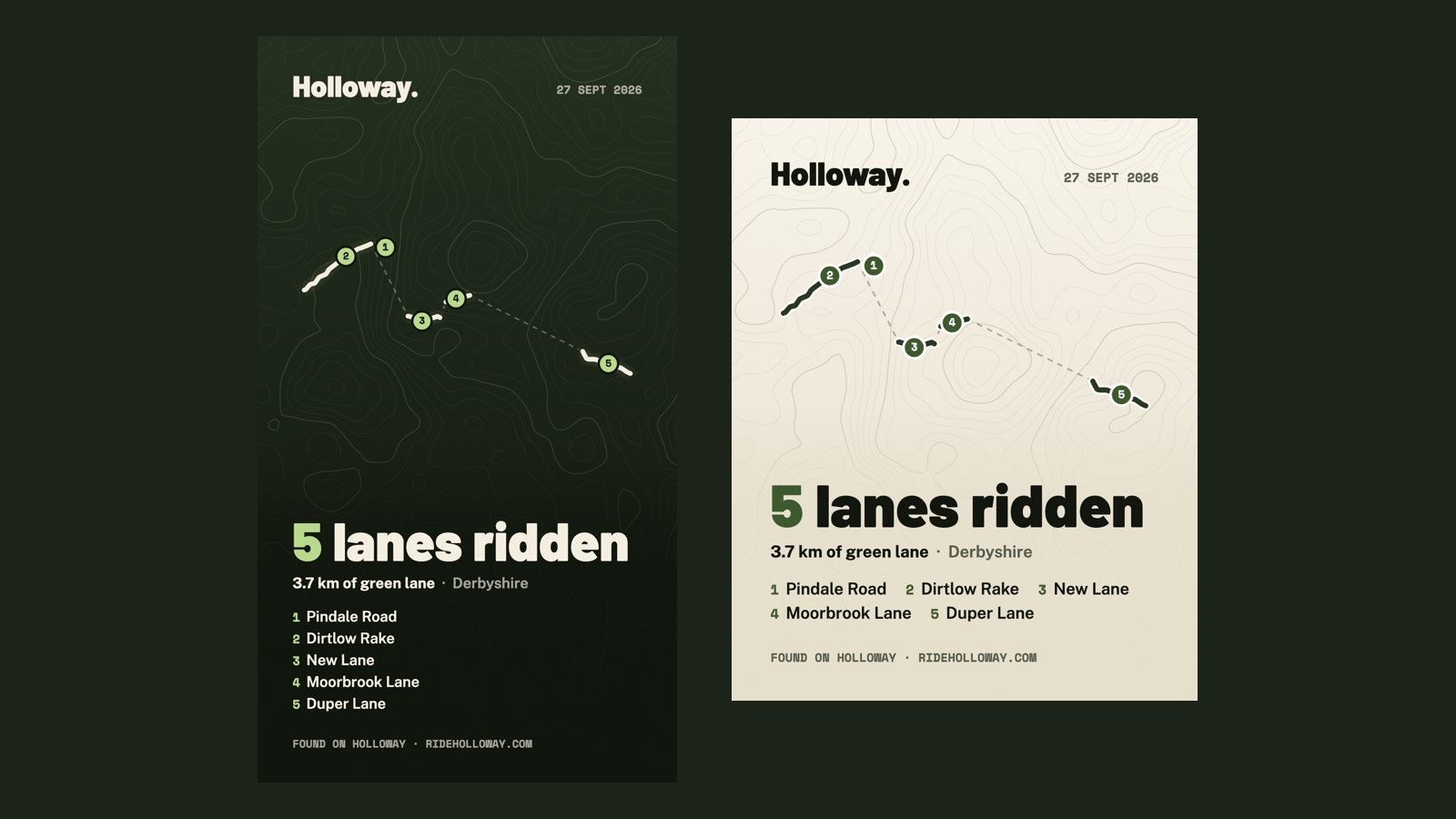
Log the lanes as you ride them, and when you finish you get a card of your day, with the lanes numbered in order, ready to post to Instagram, Facebook or WhatsApp.
The data
No single official map of green lanes exists, so we build one from several open sources and check it county by county.
Volunteers' mapping of rights of way across England and Wales. It's where most lanes start, but coverage varies a lot from county to county.
Councils' own definitive map data for BOATs and restricted byways, plus council lists of public roads where they're open to reuse. 5,651 lanes come from council data.
We read councils' Traffic Regulation Orders county by county and mark the lane sections they close, including seasonal closures that lift automatically each year. The rest of the 605 restrictions on the map come from OpenStreetMap tags or rider reports.
What we can't promise. A lane's designation is our best reading of the records, not a legal ruling, and not every council publishes its closures. That's why every lane has a Legal Status Search, and why signage on the ground always wins over the map.
Other maps
There's no one right tool. Plenty of riders use two or three of these together.
Ordnance Survey
The classic way to spot byways. OS maps show public rights of way, but not whether a lane is closed by a TRO, and a byway on the map isn't always a BOAT.
Best for: reading the landscape around a lane.
Trail Riders Fellowship
A conservation map for TRF members, built from the TRF's own local knowledge. The TRF says itself it isn't a sat-nav or route planner, and tracks can't be downloaded.
Best for: TRF members, and supporting the work that keeps lanes open. Join the TRF
Green Lane Association
GLASS's members' tool recording BOATs and UCRs in England and Wales.
Best for: GLASS members. About GLASS
Holloway
Built for the day itself: find lanes, check them, then navigate, plan a route and take it with you as GPX. Free to browse with an email sign-in.
Best for: planning and riding. Open the map
By county
Lanes open to motorcycles in each county. Tap one for its named lanes, or its trail riding guide.
Questions
A green lanes map shows the unsurfaced roads and byways you can legally ride or drive in England and Wales, mainly Byways Open to All Traffic (BOATs) and Unclassified County Roads (UCRs). A useful one also shows which tracks you can't ride, such as restricted byways and bridleways, and flags lanes that are closed by a Traffic Regulation Order.
Yes. You sign in with just an email, no password or card, and the whole map is free to browse: every lane's type, difficulty, hazards, closures and a one-tap Legal Status Search. Holloway Premium, £20 a year, adds navigation, route planning, GPX export and live navigation.
17,531 lanes shown as open to motorcycles by their recorded designation, about 5,320 miles in total, plus 12,503 restricted byways shown for reference only. Legal status can change, so always check a lane before you ride it.
OpenStreetMap, plus councils' own rights of way records from 149 authorities, and council lists of public roads where they're published openly. On top of that, we check councils' Traffic Regulation Orders county by county and mark closures and seasonal restrictions on the lanes they affect.
It's a Holloway Premium feature on every unsurfaced lane. It combines live weather with soil moisture and the last three days of rain at the lane to estimate whether the lane will be dry, damp, wet or very muddy, and warns you if a ford may be running high. It's an estimate from weather data, not a report from the lane itself.
Yes, with Holloway Premium. You can download a single lane, a whole planned route as one file, or every lane in view, with legal notes and hazards written into the file. Ready-made GPX routes are also available on the GPX Routes page.
No. Scotland has different access law and no definitive map of vehicle rights like England and Wales, so off-road motor use there is generally not legal without a specific known exception. The map covers England and Wales.
No. The Trail Riders Fellowship's Green Road Map is a conservation tool for its members, and the TRF says itself it isn't a sat-nav or route planner and doesn't offer downloads. Holloway is built for planning and riding the day. Many riders use both, and we'd always suggest joining the TRF.
Browsing the map is free with an email sign-in. Check any lane's status before you go.