


Yes, green laning is legal in England and Wales, on the right routes. That's the short answer, and it's the one worth remembering. The longer answer depends entirely on which lane you're on, what its legal designation is, and whether anything has changed its status since you last checked. This piece covers what the law actually says, so you can tell the difference between a legitimate ride and a costly mistake.
The legislation behind the answer
Two pieces of legislation matter most here. The Highways Act 1980 sets out the general framework for public highways, including the various rights of way that can exist on them. The Countryside and Rights of Way Act 2000 (commonly known as CROW) reshaped access rights across England and Wales and introduced the mechanism, under Section 53, for recording and in some cases extinguishing historic rights of way that had never made it onto the official record.
Together, these acts, along with the Wildlife and Countryside Act 1981 that governs the Definitive Map itself, form the legal backbone of what's ridable and what isn't. None of them grant a blanket right to ride anywhere that looks like a track. They grant rights to specific, classified routes, and only where that classification includes motor vehicles.
The route type decides everything
This is the part riders get wrong most often. It isn't about how a lane looks, how wide it is, or how many other vehicles have clearly used it. It's about its legal classification on the council's Definitive Map:
- Byway Open to All Traffic (BOAT): legal for motor vehicles, including motorcycles.
- Unclassified County Road (UCR): generally legal for motor vehicles, but with a caveat worth taking seriously. Sitting on a council's list of roads doesn't automatically carry the same confirmed statutory right that a BOAT has, so always check current status rather than assuming.
- Other Route with Public Access (ORPA): a rare, legacy classification with genuinely ambiguous legal status. Treat with caution and verify before riding.
- Restricted byway: no motor vehicles, regardless of surface or width.
- Bridleway: no motor vehicles, whatever the local reputation of the route.
- Footpath: no motor vehicles, full stop.
A well-used, wide, clearly vehicle-scarred track can still legally be a bridleway. Riders sometimes assume that visible tyre tracks from other bikes mean a route is fine. It doesn't. It just means someone else rode it, legally or not.
Mechanically propelled vehicles and who else uses the same routes
Legislation refers to motorcycles and similar machines as "mechanically propelled vehicles" (MPVs), and this distinction matters because different route classifications grant rights to different categories of user. A bridleway grants rights to walkers, horse riders, and cyclists, none of which are MPVs. A restricted byway adds non-mechanically propelled vehicles such as horse-drawn carriages, still no MPVs. Only a BOAT, and generally a UCR, extends that right to motorcycles and other motor vehicles.
This is also why sharing a lane responsibly matters as much as the legal question of whether you're allowed on it. Walkers, horse riders, and cyclists have every right to be on many of the same byways you do, and green laning's continued legal access depends partly on riders behaving well around them.
How a Traffic Regulation Order changes everything overnight
A route's legal status isn't fixed forever. A local authority can impose a Traffic Regulation Order (TRO) on a BOAT or UCR, restricting or banning motor vehicle use, sometimes permanently, sometimes for a defined season or a specific reason such as erosion damage or a landslip. A lane that was completely legal to ride last month can be closed to motor traffic by the time you next visit, with no obligation for that change to be obvious from the ground beyond a sign you might easily miss in poor light or bad weather.
We've written a full explainer on how TROs work and how to check for them before you ride: what is a Traffic Regulation Order, and how could one ruin your ride.
"The law here isn't complicated once you understand it, but it does punish assumptions. Check the classification, check for a TRO, then ride. That order matters."
— Mat Stuckey, founder of Holloway
A responsible rider's checklist before you head out
- Confirm the legal classification of every route on your planned ride, not just the ones you're unsure about.
- Check for any current Traffic Regulation Order, seasonal or permanent, on each route.
- Treat UCRs and ORPAs with extra caution and verify their status rather than assuming.
- Check current signage on the ground even after checking a map or app, since conditions and restrictions can change quickly.
- Carry proof of your route's legal status if you can, a screenshot or printout, in case you're challenged.
- Ride to the conditions. A lane that's fine in August can be axle-deep and eroding badly by November, and damage caused by riding in the wrong conditions is one of the fastest ways routes end up with a TRO.
Where to check before you ride
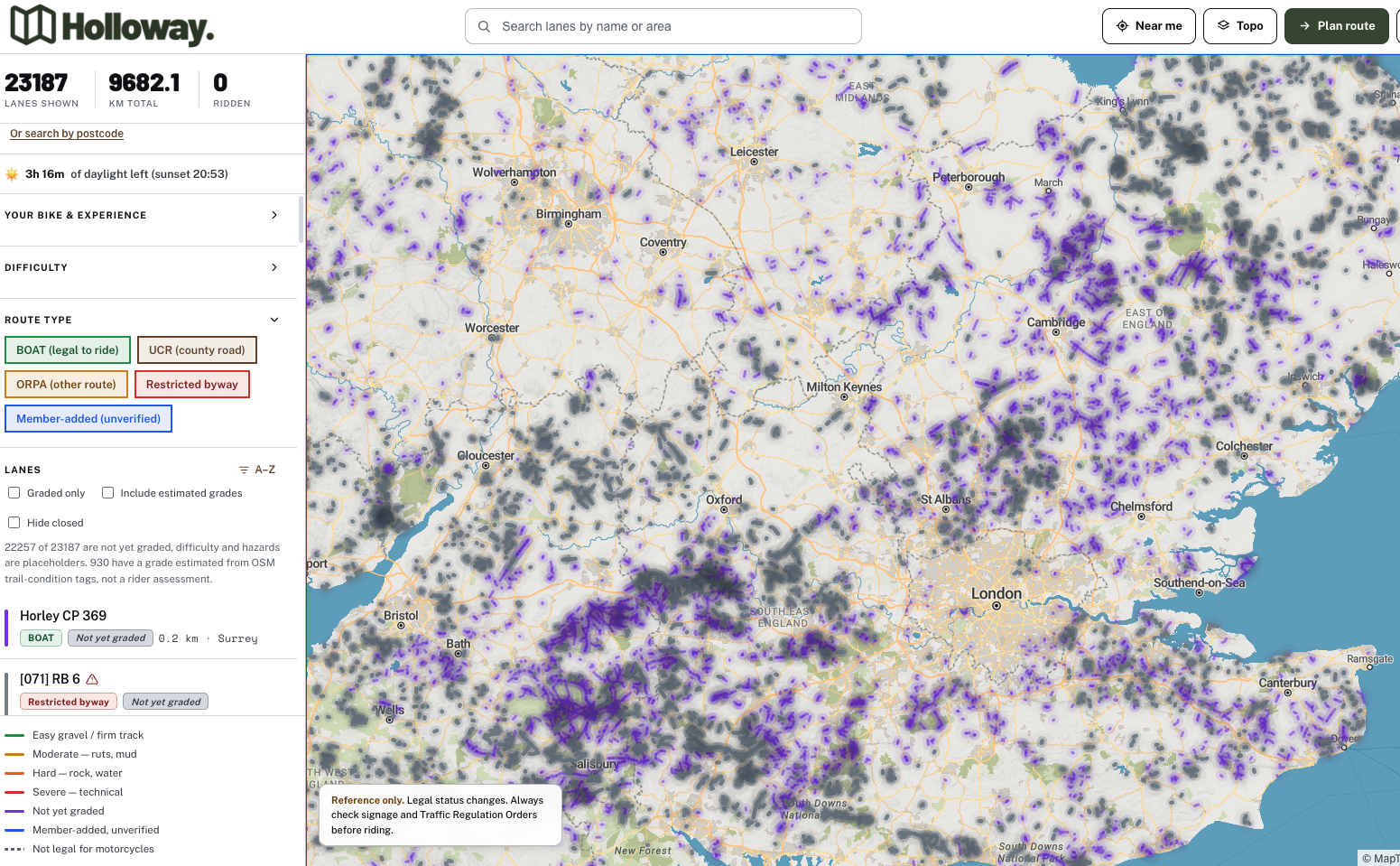
Council Definitive Maps are the underlying legal record, as we've covered in our piece on what the Definitive Map is and why it matters, but they're not always easy to search quickly, and TRO information often sits in a completely separate part of a council's website, if it's published at all.
This is exactly the gap Holloway fills. You can check a lane's legal type, current status and any closures on Holloway's map before you set off, without trawling through separate council pages for classification and TRO information.
Legal status can change, and this article is reference information rather than a live feed. Always check current signage and the latest TRO listings before you ride, whatever tool you've used to plan.
Ride on the right side of the law
Holloway is free to use for exactly this kind of check: every legal green lane in England and Wales, its classification, difficulty, hazards, and whether it's currently open. For £20 a year, Holloway Premium builds on that with full route planning, road-following connectors between lanes, GPX export, exact coordinates, and live weather, everything you need to plan a full day out and know you're riding on solid legal ground.