

Somewhere in England or Wales right now, there's a lane that's been used as a public route for well over a century, that appears on old tithe maps and enclosure awards, and that still isn't on the current Definitive Map. Section 53 of the Wildlife and Countryside Act 1981 is the mechanism that can add, correct or extinguish a right like that. There are genuinely two separate deadlines that get talked about under this same banner, and they get mixed up constantly, including in some of our own earlier coverage of this. Here's what each one actually covers.
What Section 53 actually does
The Wildlife and Countryside Act 1981 is the Act that created the Definitive Map system itself, and Section 53 is its general mechanism for recording, correcting or extinguishing a right of way, the same provision a Definitive Map Modification Order is made under. See our full glossary if any of that shorthand is new to you.
Two later Acts each added their own cut-off to this general mechanism, for two completely different categories of route, and this is the part that most commonly gets confused.
The vehicular cut-off already happened, in 2006
The Natural Environment and Rural Communities (NERC) Act 2006 extinguished unrecorded historic rights for mechanically propelled vehicles, the sort of evidence that could support a new BOAT or UCR claim based on old horse-and-cart use. That cut-off took effect in 2006 and has already passed. Subject to a handful of narrow exceptions, mostly covering a landowner's own access to their land, no new vehicular right can now be established on an unrecorded route purely from historic use. If you've heard someone say a 2026 or 2031 deadline threatens to erase BOATs and UCRs from the map, that's not accurate, that door closed years ago, quietly, without most riders noticing.
The footpath and bridleway deadline, 2026, then 2031, now facing repeal
The Countryside and Rights of Way Act 2000 (CROW) set a separate cut-off, for unrecorded historic footpaths and bridleways specifically, based on pre-1949 documentary evidence. This is the one most commonly referred to as "the 2026 deadline". It has nothing to do with vehicular rights, BOATs or UCRs at all.
That date has moved more than once. Following lobbying, including from the Country Land and Business Association, a 2023 statutory instrument deferred it from 1 January 2026 to 1 January 2031. Then, in 2024, the government went further and announced it intends to repeal the cut-off altogether, with no date set for when that repeal will actually happen. As things stand, there's no live deadline for unrecorded footpaths and bridleways at all, though a repeal that's been announced but not yet passed into law is still worth treating with some caution rather than banked on completely.
Why this still matters for green laning, even though the vehicular door is shut
None of this means unrecorded historic rights of way have stopped mattering. Footpaths and bridleways still make up the large majority of what's missing from Definitive Maps across England and Wales, and a genuine historic right, walkers' or horse riders', is still worth recording properly regardless of what happens to the cut-off. For green laning specifically, the honest message is different from "beat the deadline": the vehicular cut-off already happened, so the real value of Section 53 now is correcting and completing the record for routes whose classification is disputed or wrong, not racing to file new claims based on historic use before a deadline that no longer applies to them.
"I used to describe this as a race against 2031. It isn't, not for green lanes. The vehicular door shut in 2006. What's left is making sure the record's actually right for what's already there, not chasing a deadline that was never about BOATs in the first place."
— Mat Stuckey, founder of Holloway
What the TRF and other groups are doing
The Trail Riders Fellowship has been one of the more active voices on this issue, both in past lobbying and in supporting the practical work of researching and correcting the record for routes that matter to the green lane network, working through the ordinary Section 53 and DMMO process covered in our piece on objecting to a DMMO. Other rights of way groups, representing walkers, cyclists and horse riders, have their own stake in the footpath and bridleway side of this, since that's the part still genuinely in play.
What an individual rider can do right now
You don't need to be a rights of way specialist to help. A few practical steps are open to any rider:
- Flag routes whose recorded classification looks wrong. If a lane's current status doesn't match what you'd expect from its history or how it's used, that's worth raising with the TRF or your council's rights of way team, through the ordinary DMMO process, not a race against a vehicular deadline that's already passed.
- Support genuine footpath and bridleway claims if you're also involved with walking or riding groups, that's the side of Section 53 still genuinely time-sensitive, even with a repeal announced but not yet law.
- Join or support the TRF. Much of this work is resourced through TRF membership and campaigning capacity, so joining is a direct way to contribute even if you never attend a local meeting.
- Apply for a Definitive Map Modification Order (DMMO) through your local council if you hold solid evidence that a route's current classification is wrong. Your council's rights of way team can advise on what evidence is required.
- Keep an eye on Holloway as classifications are updated, so you're riding on current, accurate information rather than an outdated assumption about a lane's status.
Keeping track as the picture changes
As claims are processed and routes are added to or confirmed on the Definitive Map, a lane's legal status can change, sometimes in a rider's favour, occasionally not. You can check a lane's current legal classification on Holloway's map rather than relying on memory or an old assumption, and it's worth doing that check regularly rather than once and forgetting about it. For the basics of what the Definitive Map is and how councils maintain it, see our earlier piece: what is the Definitive Map, and why does every green laner need to know it.
This article is reference information, and law in this area is subject to change, including the CROW repeal itself, which had been announced but not yet passed into law at the time of writing. Always check the current position with your local council or the TRF before acting on anything related to an unrecorded route.
Don't wait for a deadline that doesn't apply to you
Holloway is a modern, simple tool to find legal green lanes, byways and more across England and Wales, free to browse with every lane's classification, difficulty, hazards, and loads more, all in one app. Desktop and mobile!
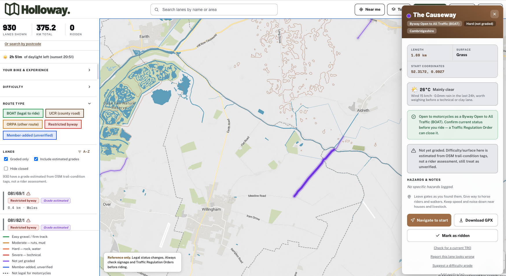
For £20 a year, Holloway Premium adds full route planning, road-following connectors between lanes, GPX export, exact coordinates, and live weather, giving you everything needed to plan and ride a full day out with the current legal picture in hand.