 GPX Routes
Back to the app
GPX Routes
Back to the app
Motorcycle GPX route · Somerset
A genuine loop through 10 real UCRs around Bruton and Frome in Somerset. Links Holcombe Lane, Studley Lane, River Alham, Walter's Hill, Creech Hill Lane, Sunny Lane, Nettlecombe Hill, Pitcombe Hill, Hurn Lane and Horns Lane with the real roads connecting them. Every lane is currently open and legal to ride.
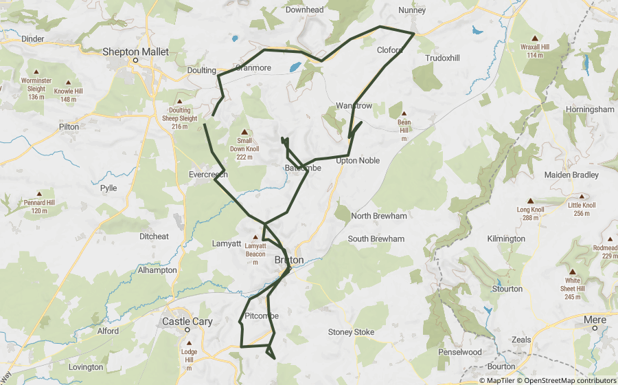
This is a real, off-road motorcycle route, built entirely from lanes Holloway's own mapping already shows as currently legal to ride. It strings together real BOATs and byways with the actual roads that connect them, so the GPX traces the whole route, not just the off-road sections in isolation.
Every lane here is a UCR, legal to ride but a highway authority listing doesn't carry quite the same statutory confirmation as a formal BOAT designation, check locally before relying on this. No fords or closures currently flagged.
Part of Holloway Premium. The file traces the real off-road byways and the real road links between them, ready to load onto a motorcycle GPS unit or a phone app.
Reference only. Legal status can change, always check signage and current Traffic Regulation Orders before riding, whatever this page or the downloaded file shows. See the lane's own page in the app for its current, live legal and closure status before setting off.