
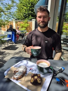
It's been a busy stretch on Holloway. Rather than a separate post for each thing, here's a proper roundup of what's actually shipped lately, what it looks like, and why it's there.
Points of interest, now rolling out county by county
We covered this properly in its own post, so the short version here: switch on "Show points of interest" and the map brings up historic sites, ruins, viewpoints and monuments near your ride, not just lanes. It's rolling out region by region, checked rather than rushed, the same discipline as grading a lane properly.
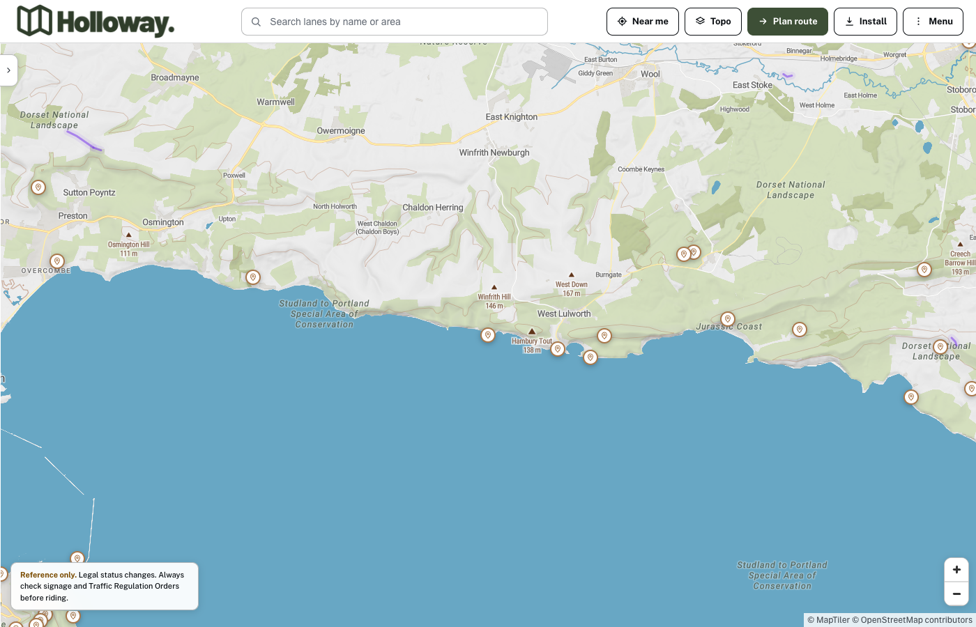
Points of interest along the Dorset coast, switched on from the sidebar filters.
Tap one and you get a real write-up and a photo, not a placeholder pin. Corfe Castle's own entry is a good example of what every point of interest actually looks like once you open it.
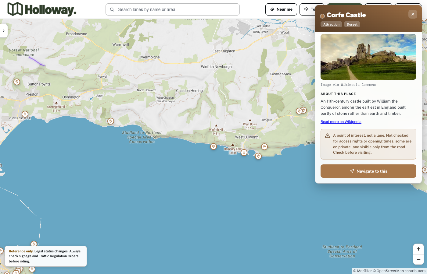
A point of interest opened, with a real photo, a short write-up and a one-tap Navigate to this button.
Bring in your own GPX tracks
This closed a real gap. Holloway has been able to export a GPX file at three levels, a single lane, a full planned route, or a bulk export of whatever's on screen, for a long time. There was never a way to load one back in. Now there is: "Import GPX & navigate" in the Menu takes any GPX file, from anywhere, another rider's export, a route you planned somewhere else, and drops it straight into live navigation.
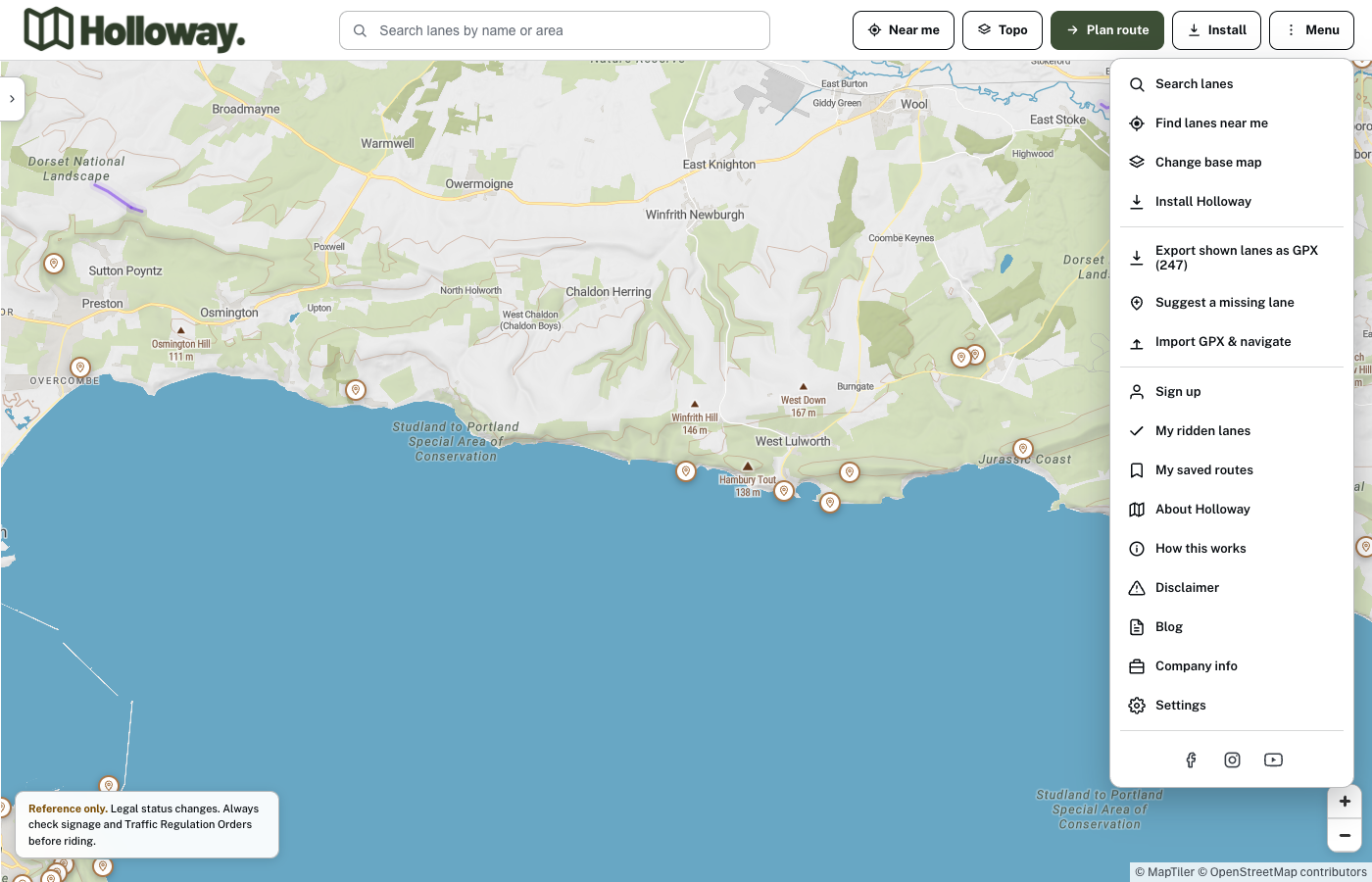
Import GPX & navigate, in the Menu, next to the existing export options.
It's genuinely simple on purpose. Pick a file, and if it's a real GPX track, you're navigating it within seconds, no need for it to already exist as a lane in Holloway's own database.
Save a route and come back to it later
Planning a full day across several linked lanes has worked for a while, but until now the only way to keep a route was to export the GPX and hang onto the file yourself. Routes can now be saved straight to your account, named, and reloaded whenever you're ready to ride them.
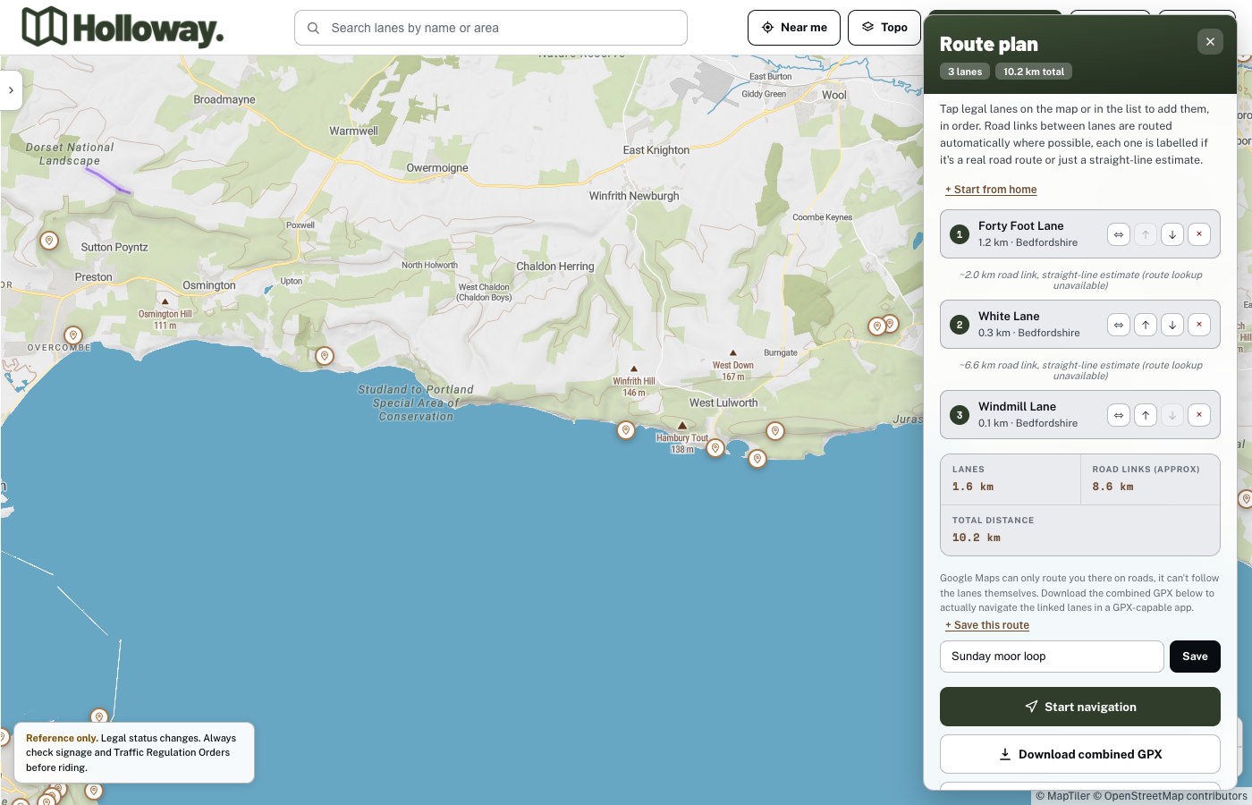
A planned route, real lane names and distances, ready to save under its own name.
Saved routes get their own list under "My saved routes" in the Menu, each one showing lane count, distance, and a tap to load it straight back into the planner, home postcode and any manual lane flips included.
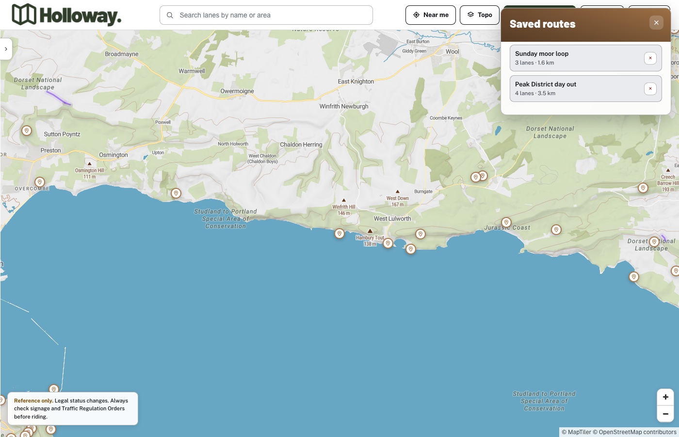
Saved routes, each one a tap away from reloading straight into the planner.
A live nav view that's actually easier to read while riding
The moving map got a proper rework. It's flat by default now instead of tilted, since a 3D perspective mostly just eats screen space at the slow, technical speeds green laning actually happens at, with a one-tap toggle if you want the tilted view back. The rider arrow is bigger and unmistakably a directional arrow, the whole info panel moved to the bottom of the screen so the map itself is easier to see, and a new bar tells you when the lane you're actually on right now has a real hazard or closure logged against it, not just what's coming up next.
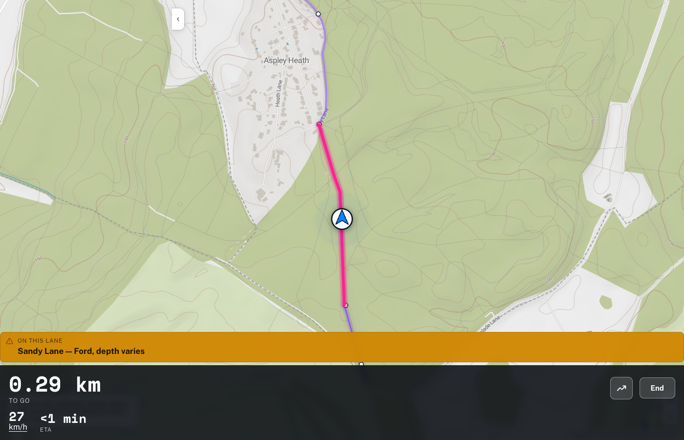
The redesigned nav view: flat by default, hazard-aware, info panel at the bottom.
"None of this is flashy for the sake of it. Every one of these came from someone actually using the app and telling us what was missing or what was getting in the way. That's the only roadmap that matters at this stage."
- Mat Stuckey, founder of Holloway
Holloway is a free green lane finder, BOAT map and route navigation tool for England and Wales. Browsing the map, checking legal status and hazards, and points of interest are all free, no account needed. GPX import, route planning and saving, and live navigation are part of Holloway Premium, £20 a year, with £1 from every subscription going straight back into keeping lanes open and maintained.