

You already know what a green lane is. You just want to know how to actually find one near you and go ride it.
The quick answer
- Fastest and free: open Holloway, search your postcode, see every legal lane near you with its current status. No account, no membership, seconds not hours.
- Best for supporting access work: join TRF (£58/year) or GLASS (£59/year). Their own maps are a bonus, the membership itself funds the work that keeps lanes legally open.
- Most authoritative, slowest: read the council's Definitive Map yourself, or an OS Explorer map. It's the actual legal record everything else is built from, but it's sheet by sheet, council by council.
- Real but unreliable: ask in a Facebook group or forum like r/MotoUK. Good for local knowledge, bad for knowing if anything's changed since the post was written.
The fastest way: Holloway's free map
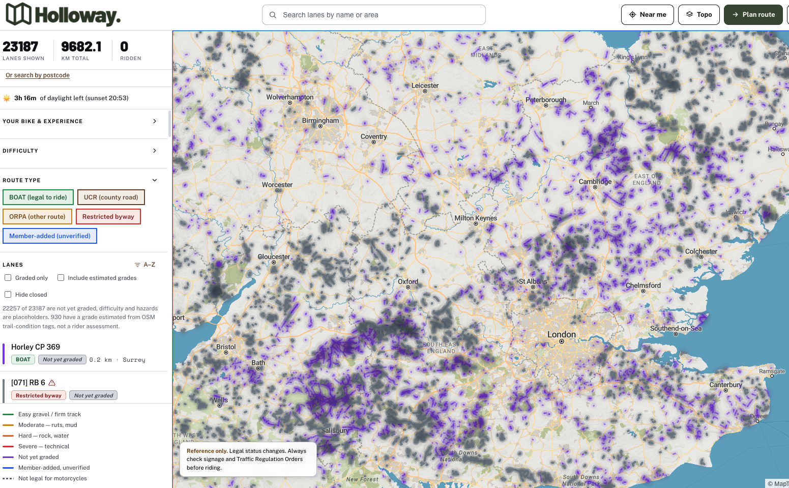
Open the map, search your area, ride. Holloway shows every legal green lane across England and Wales, free, no account, with its real classification, difficulty, length, hazards and a one-tap Legal Status Search so you can check it's still open before you commit a day to it.
TRF and GLASS still matter, more on that below, but if what you actually want right now is to see a legal lane near you and go, this is the quickest route there. Holloway Premium unlocks turn-by-turn navigation to every single lane on the map, plus full route planning, GPX export and exact coordinates, for just £20 a year.
The traditional way: TRF or GLASS membership

Join for the access work, use the map as a bonus. The Trail Riders Fellowship (£58/year) and GLASS (£59/year) both exist primarily to protect legal green lane access, not to sell you a map. TRF's Green Road Map and GLASS's Trailwise 2 mapping are built from years of local branch knowledge, and they're a genuinely good reason to join even before you factor in a single lane.
If you can only afford one thing, this is the better spend than a subscription app, because it funds the TRO consultations and landowner negotiations that decide whether there's anything left to map in ten years. More on what TRF membership actually gets you, most of it applies equally to GLASS.
The legal source: OS maps and the Definitive Map
Slower, but it's the actual record everything else is copied from. Every route's legal status comes down to the council's Definitive Map and Statement. OS Explorer maps mark rights of way in their own key, footpath, bridleway, restricted byway and byway all look different, check the legend rather than assume. Most councils also publish a definitive map online, quality varies wildly from one county to the next.
Worth understanding even if you never use it directly day to day, it's what every app, including Holloway, is ultimately checked against. Full explainer here if you want it properly.
The social way: forums, Facebook groups, word of mouth
Great for confidence, risky for legal status. A mate showing you round a local favourite is hard to beat for actually building confidence on the bike, and it's how most riders still find their first few lanes. The problem is a post from a few years ago doesn't know about a TRO that went through last spring. Why this falls short, in full. Short version: treat anything you hear this way as a lead to verify, not a green light.
"When I started out, finding a lane meant a paper OS map on the kitchen table, a forum thread I half trusted, and no way of knowing if anything had changed since either was made. I built Holloway because that whole process should take seconds, not an evening."
— Mat Stuckey, founder of Holloway
Before you ride it
- Confirm the legal classification, not just that it looks like a green lane on the map.
- Check for a current closure or TRO. Status can change even when the map hasn't.
- Be honest about whether it matches your bike and experience. A technical byway is a bad place to find that out.
Know your lane types
Legal to ride: a Byway Open to All Traffic (BOAT), and generally an Unclassified County Road (UCR), though a UCR's legal footing is narrower and worth checking rather than assuming. Not legal, no matter how wide or well used the track looks: a restricted byway, a bridleway, or a footpath. Full classification guide here if you want every type explained properly.
What happens if you ride a lane that isn't legal
Riding a mechanically propelled vehicle without lawful authority on a footpath, bridleway or restricted byway is a specific criminal offence under Section 34 of the Road Traffic Act 1988, it carries a fine, separate from any question of trespass. Riding a BOAT or UCR that's currently under a Traffic Regulation Order is its own offence too, even though the lane is normally legal, we cover that here. Beyond the legal risk, riding somewhere you shouldn't is one of the fastest ways a lane ends up closed for everyone else too, landowner and council complaints are what actually drive most closures.
Common questions
Is there a free way to find green lanes? Yes, Holloway's map is free with no account. Council definitive maps are free too, just slower and less consistent county to county.
Do I need to join TRF to ride green lanes? No, it's not a legal requirement. Genuinely worth joining anyway for the access work, just not a prerequisite.
How do I know if a lane is currently open? Type and legal status rarely change, but closures and TROs do. Check a specific lane's current status before riding, don't trust a map alone, however recent.